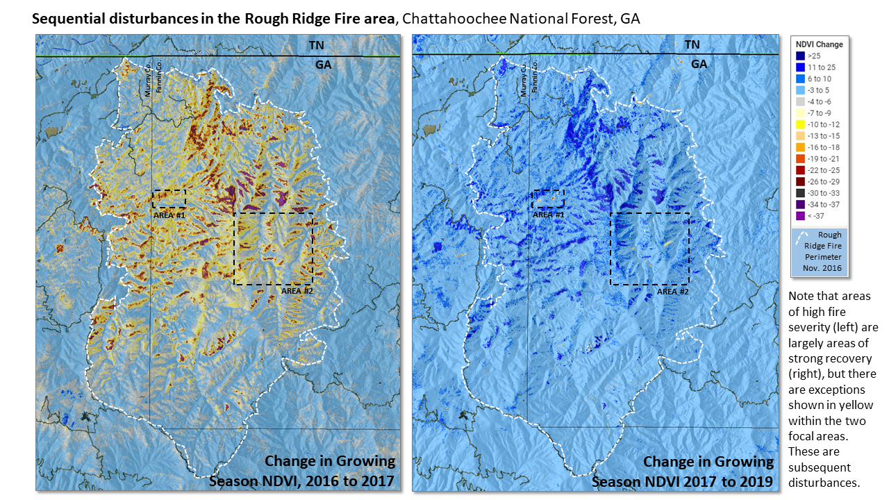
Sequential disturbances within the 2016 Rough Ridge Fire, Cohutta Wilderness, GA
Fire severity mapping typically captures only the immediate or early impacts of wildfire, yet we know that secondary or delayed mortality is common in the Southeast, in particular. Mortality often occurs when trees stressed by fire become vulnerable to insects or diseases, such as southern pine beetles. At landscape scale, little is known about these secondary effects due to the paucity of consistent long term monitoring. High resolution remote sensing provides a mechanism to address how recovery and secondary disturbances occur at landscape scale over multiple years.
Having this monitoring capability within areas of fire disturbance is especially important because traditional approaches to forest monitoring, such as aerial surveys, are readily confounded by dead trees killed more directly by the fire. Often secondary fire mortality is adjacent to areas with initial fire mortality, so it is challenging to recognize secondary change without a systematic change-over-time methodology. Accounting for all fire-associated change is critical for understanding the full consequences of wildfire.
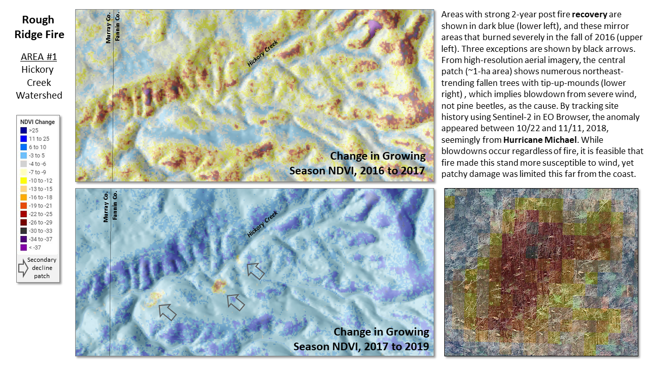
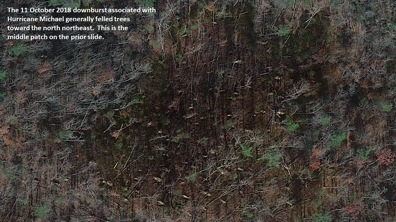
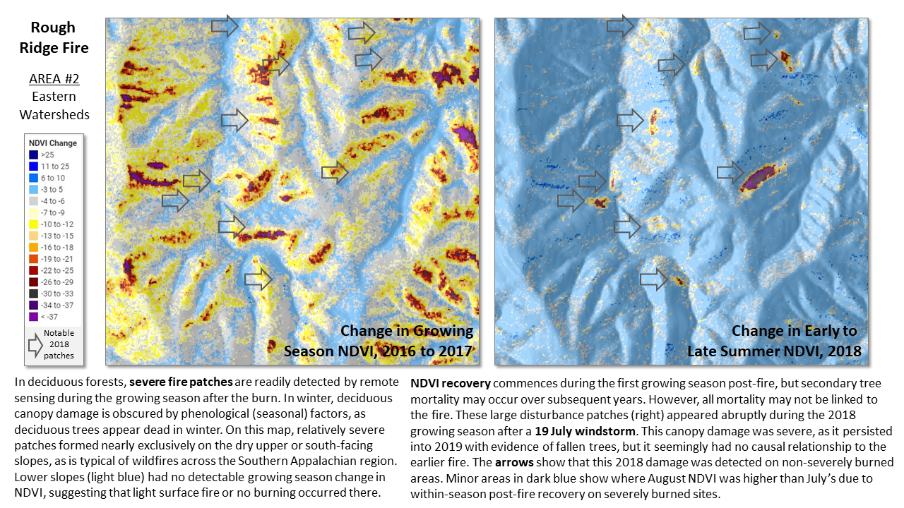
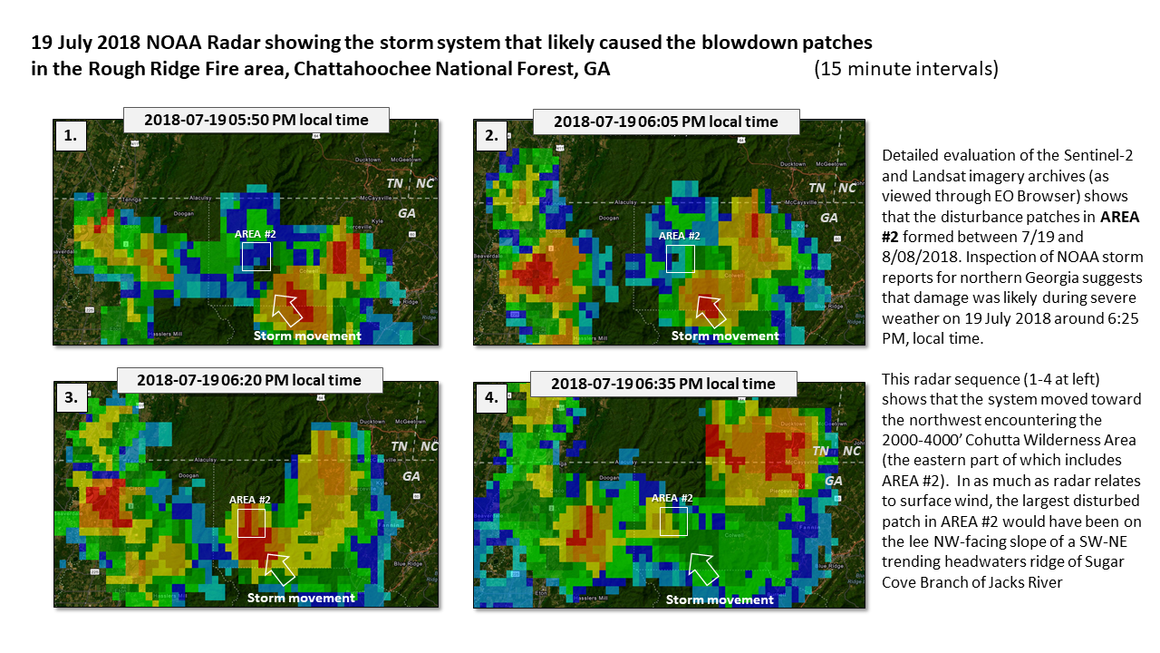
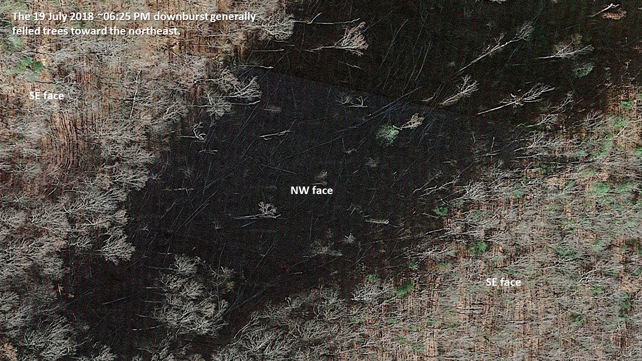
However, the Southeast experiences frequent disturbances from many different causes, not just fire, so mortality in the years after a fire could also be from non-related causes. The two examples of severe weather damage from two different wind events within the area burned by the Fall 2016 Rough Ridge Fire are remarkable because similar damage has been hard to identify outside burn scars. This may be due to the inherent vulnerability of these rugged mountain landscapes, or there may be a causal relationship, such as fire somehow weakening the trees. This requires more intensive research to resolve.
The topographic positions of these two types of disturbances are particularly remarkable. Severe fire is commonly associated with dry, upper slopes or south aspects in the Southern Appalachians, but these blowdown patches occurred on more mesic sites.