May 2025 Somerset-London KY Tornado
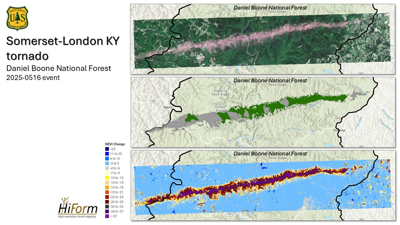
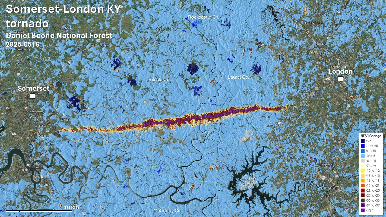
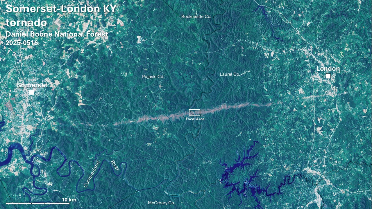
On May 16, 2025, a deadly 60 mile long tornado struck southeastern Kentucky. This was part of a broader tornado outbreak, but the effects of the Somerset-London tornado for the Daniel Boone National Forest were especially notable because of its EF3 to EF4 intensity.
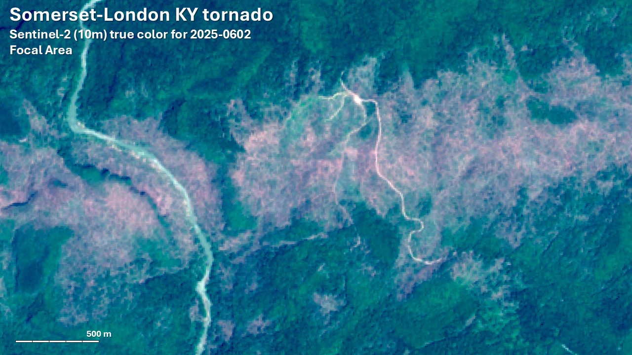
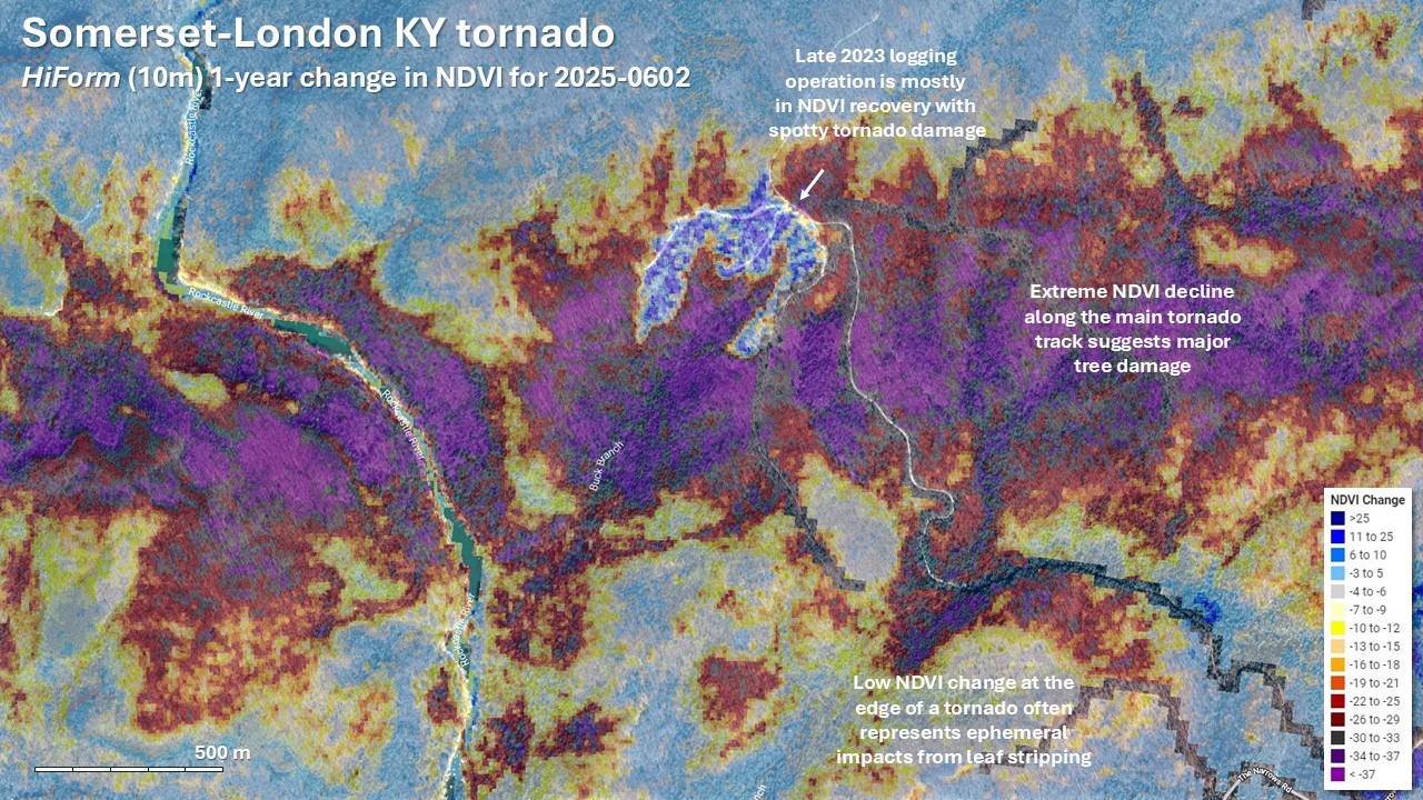
Satellite imagery is an excellent tool for revealing the footprint of wind impacts, but assessment is needed to accurately map damage to deciduous and mixed deciduous-conifer forests. Some imagery is of sufficiently high resolution to resolve fallen trees directly, but without that, change in foliage is our best indicator. However, leaves are absent for hardwoods prior to green-up, while conifers, like pine and hemlock, are good indicators of structural damage year-round. Moreover, during the growing season, moderate wind speeds often strip the foliage off hardwoods without causing meaningful structural damage. This means that regardless of the season, the initial pattern of observed change may reflect species composition as much as actual tree damage. In winter assessments, severe hardwood damage may be under-represented, and when conducted in the growing season damage may be over-represented. Fortunately, analysts have another powerful measure with streaming satellite technology, and that is the persistence of the disturbance. Leaf stripping in spring is often manifest as a delay in green-up relative to adjacent undisturbed areas with full recovery by early to mid summer. Meanwhile, true crown damage in hardwoods should persist longer, often for the entire growing season or for multiple years.
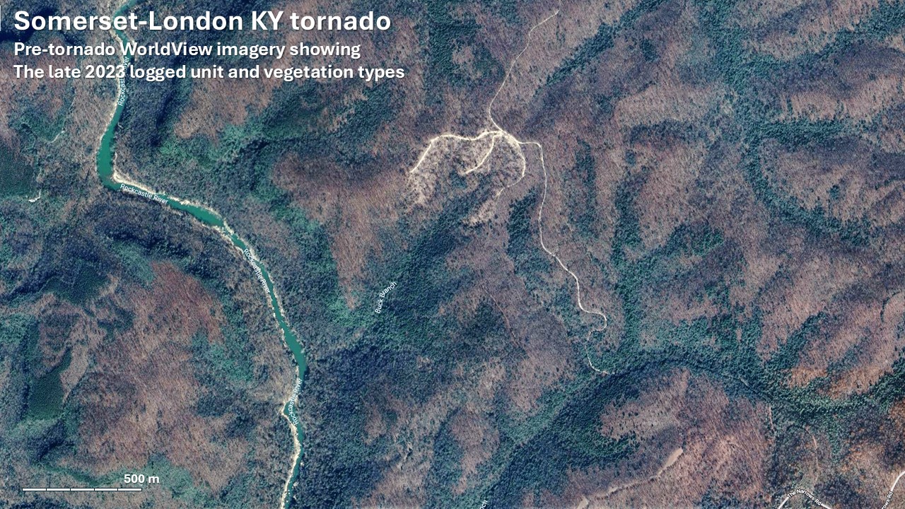
Note the fine-resolution pattern of effects on slide 5. This recent logging unit largely showed an increase in NDVI over the last year despite being in the tornado track because it is in successional recovery. Scattered declines within the unit suggest there was some tornado damage, but the influence of multiple disturbances at short and longer time scales are revealed by this technology.