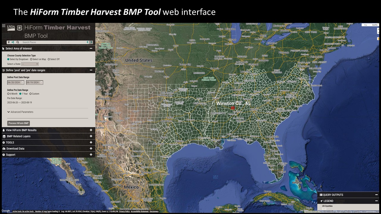
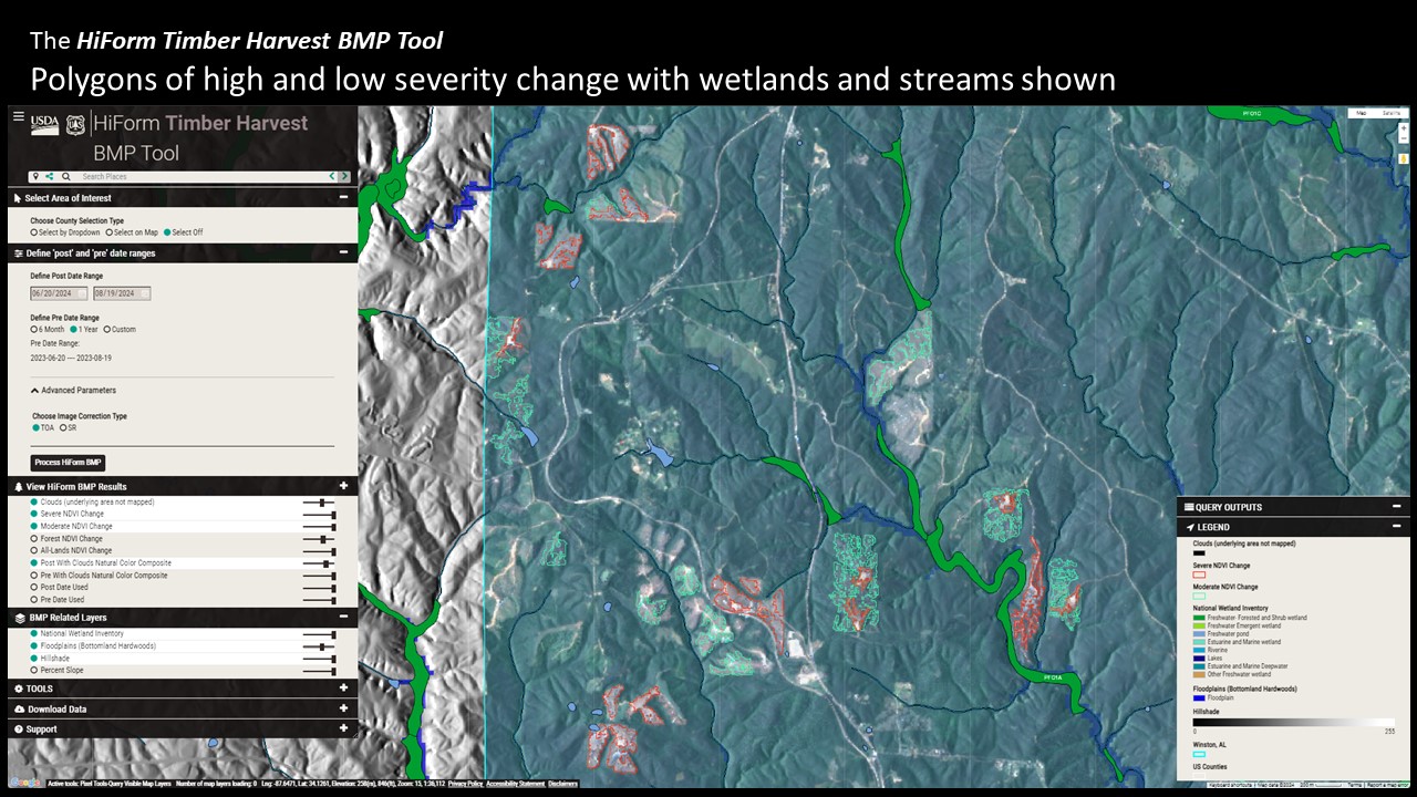
HiForm Timber Harvest BMP Tool
The HiForm Timber Harvest BMP Tool is an open web-based application that was developed by the USDA Forest Service's Eastern Forest Environmental Threat Assessment Center in collaboration with the US Forest Service Geospatial Office (GO), RedCastle Resources Inc., and the Southern Group of State Foresters.
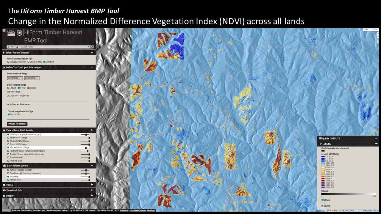
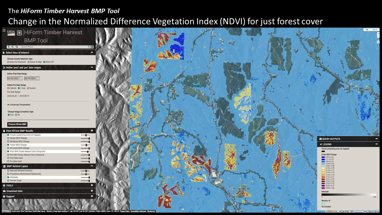
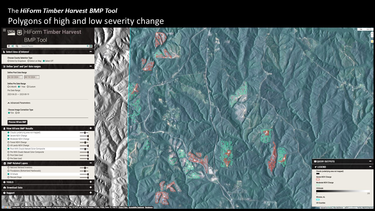
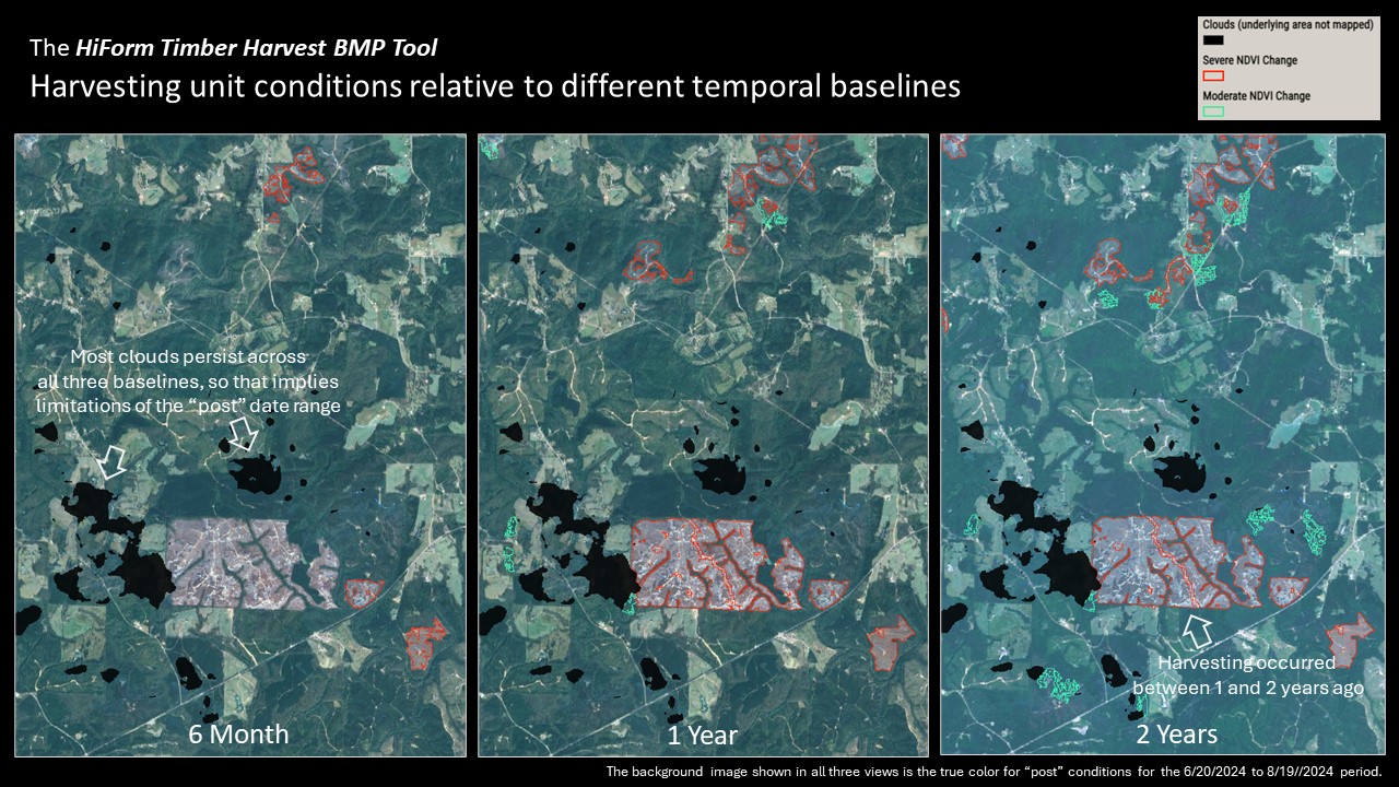
This tool uses Google Earth Engine to monitor timber harvests in the south with respect to potential impacts to soil and water. It includes both polygon and point export options which can be useful for prioritizing and locating sites in the field in addition to the basic NDVI change rasters similar to the broader HiForm products.
While only southern region counties are shown, county-level analyses can be performed for any county in the US. Disturbances other than timber harvesting are also routinely included.