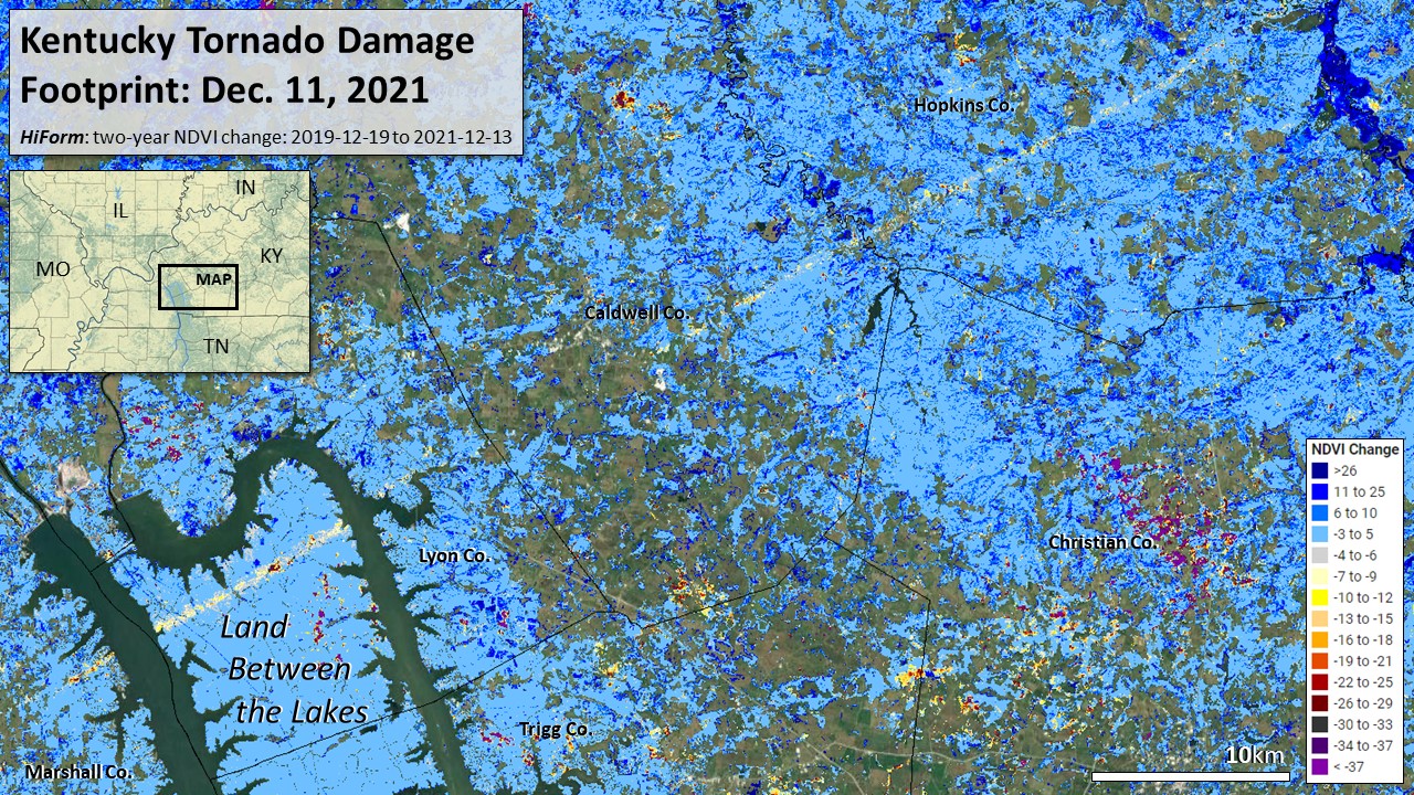
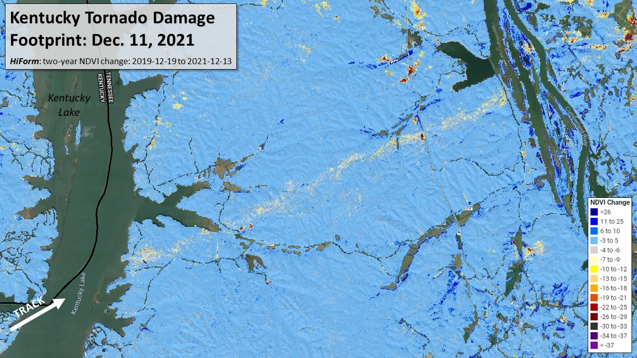
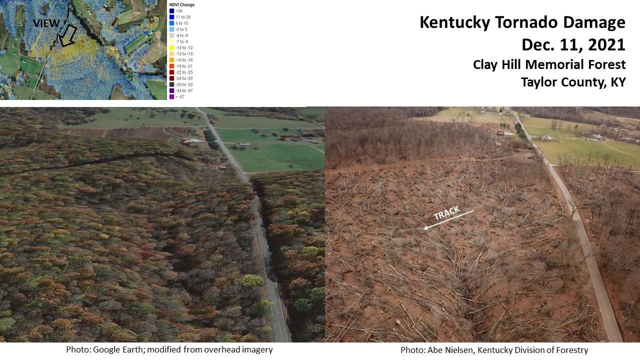
December 2021 Western Kentucky Tornadoes
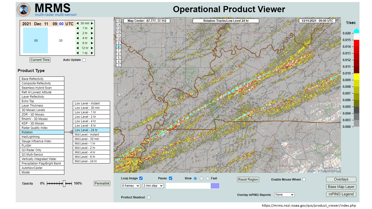
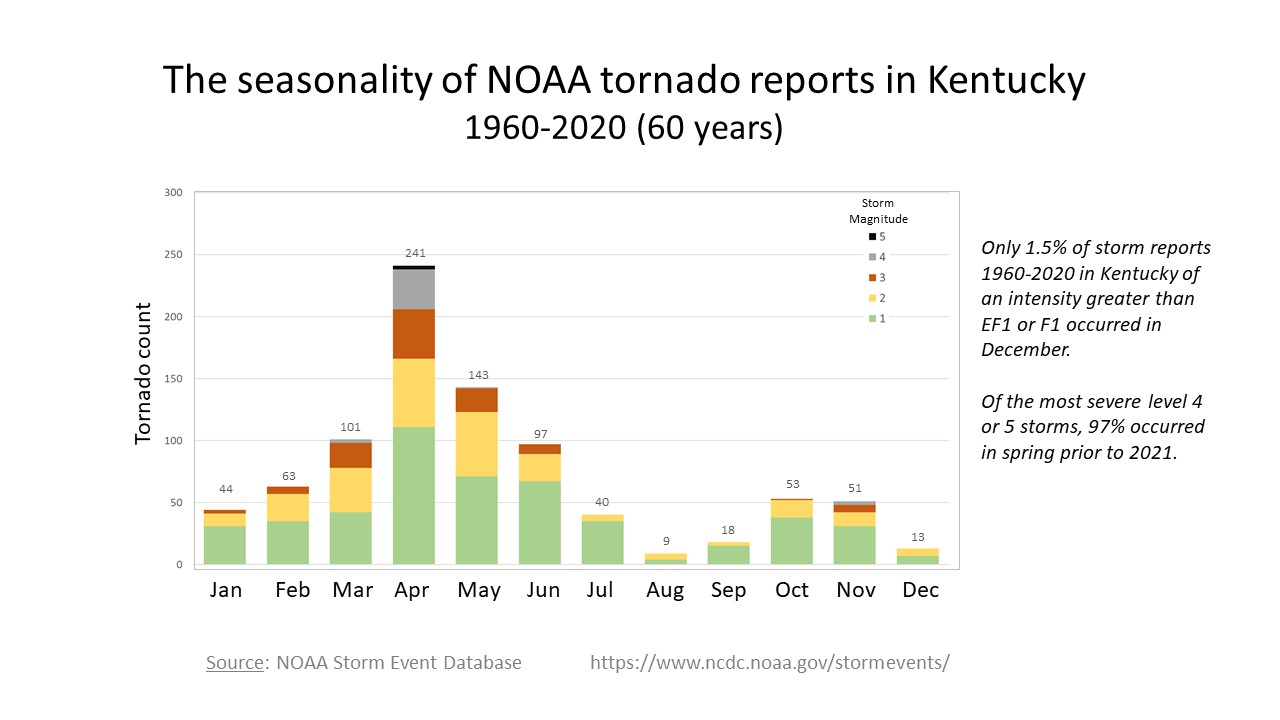
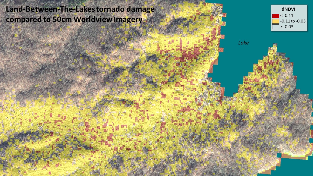
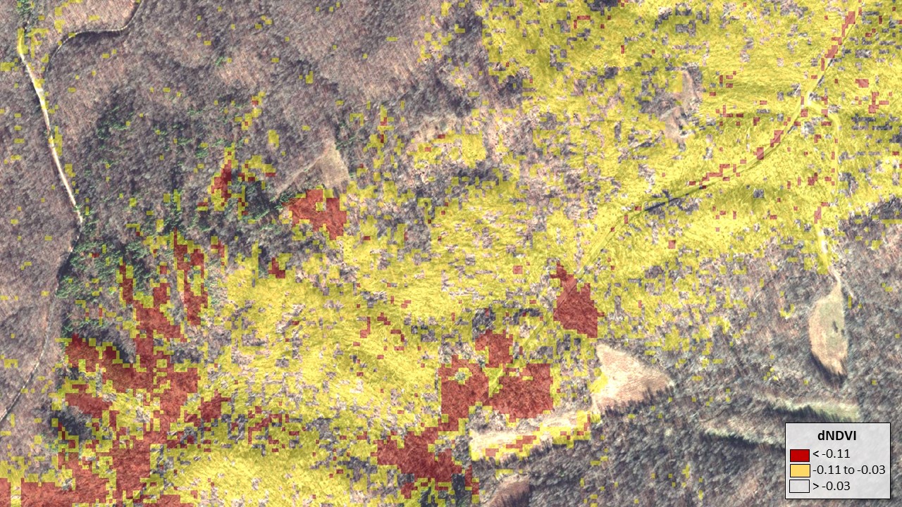
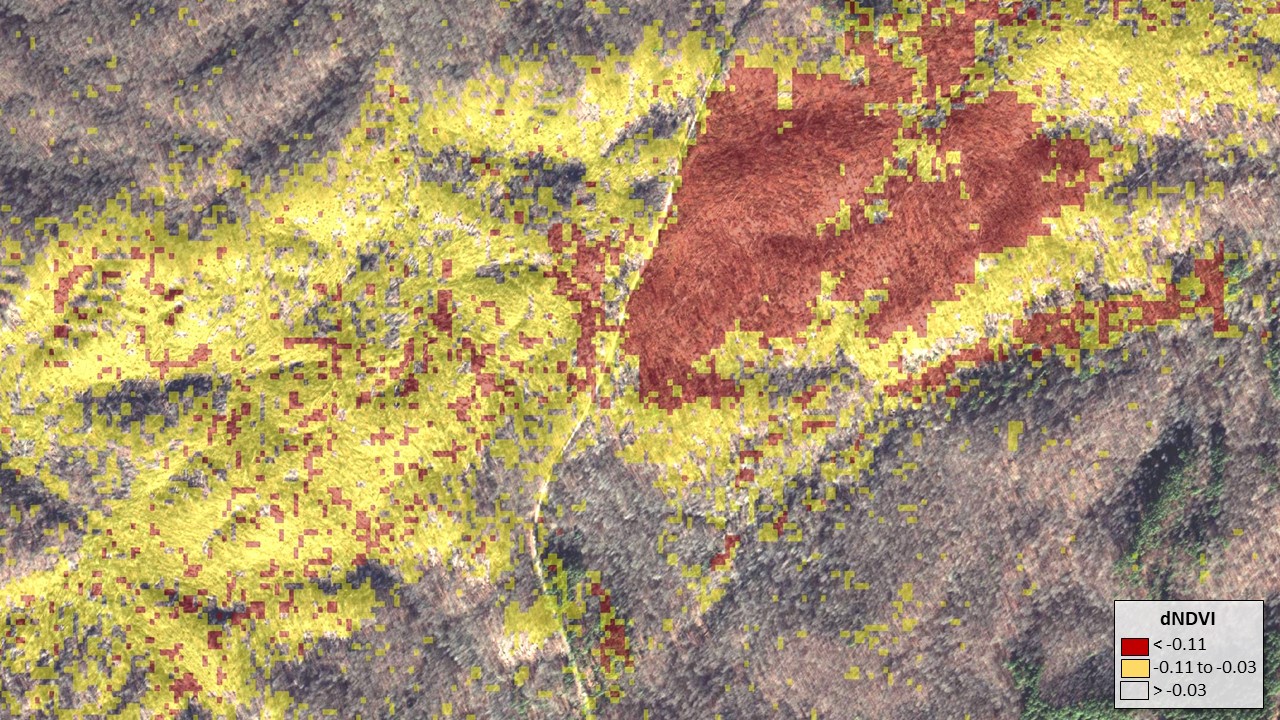
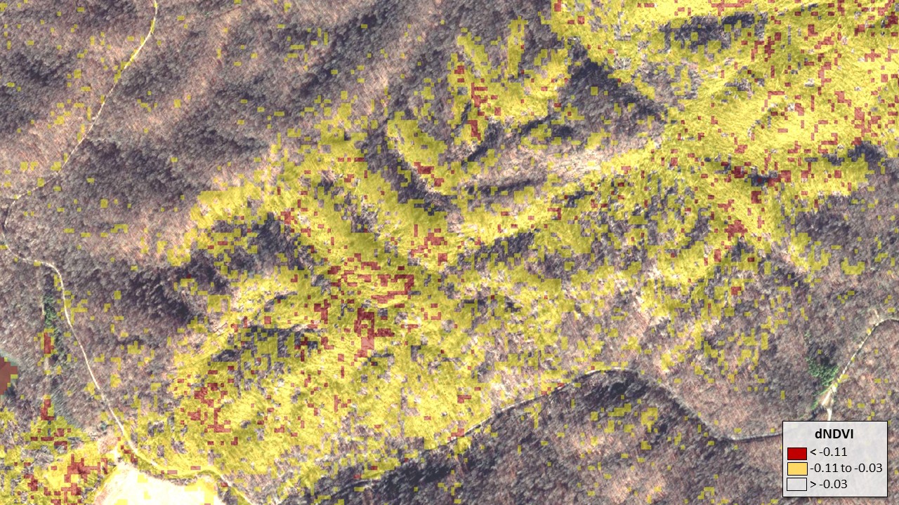
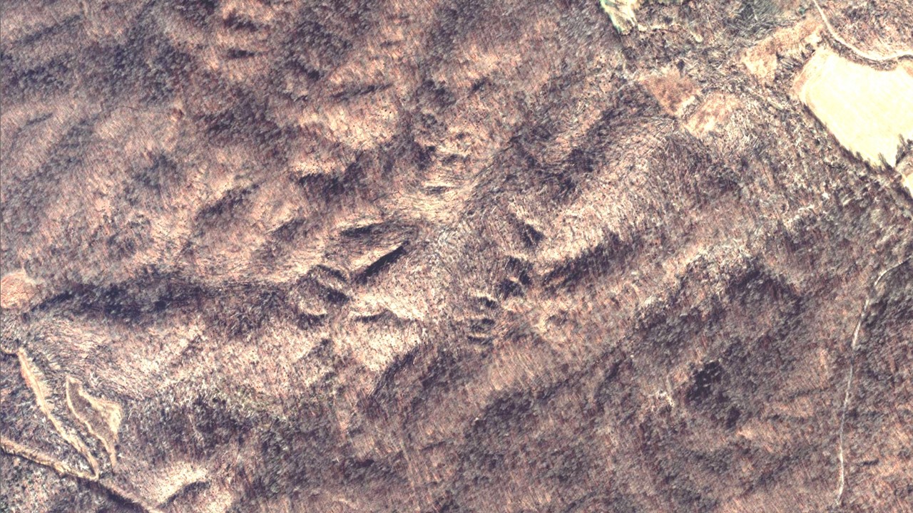
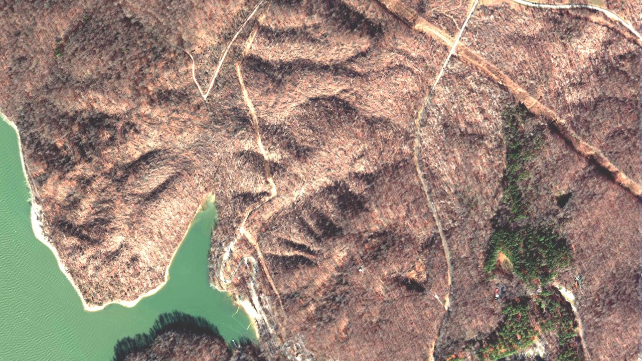
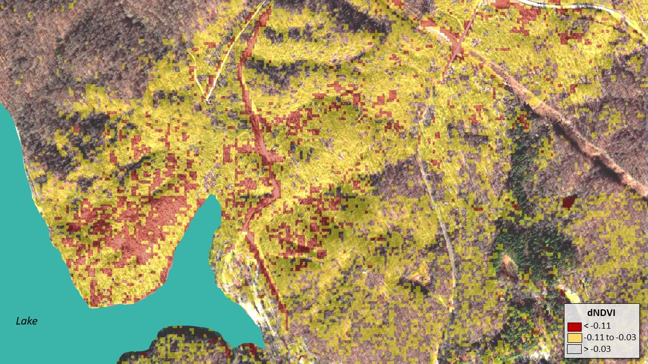
On December 10-11, 2021, a rare winter tornado outbreak struck western Kentucky and adjacent states. These storms caused widespread destruction to homes and led to the loss of over 90 lives. Compared to developed areas, relatively little is known about the effects of these storms on the forests of the region, especially in near-real-time. Use of early detection technology from satellites provides our first glimpse of the storm footprint with some nuance-needing insights into the initial impacts or severity.
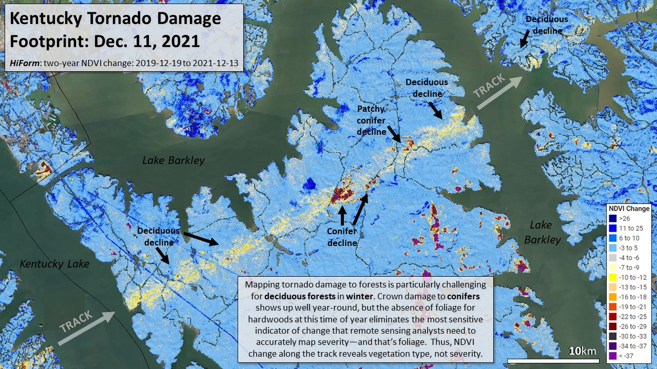
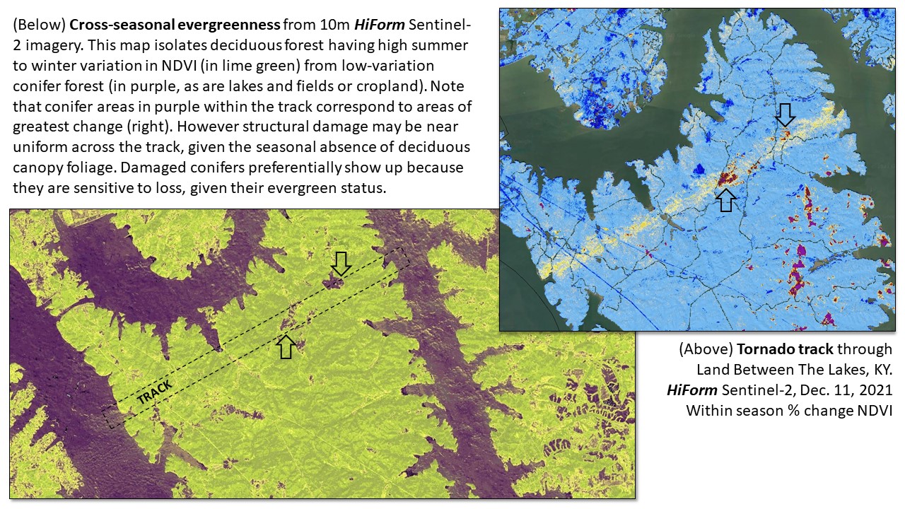
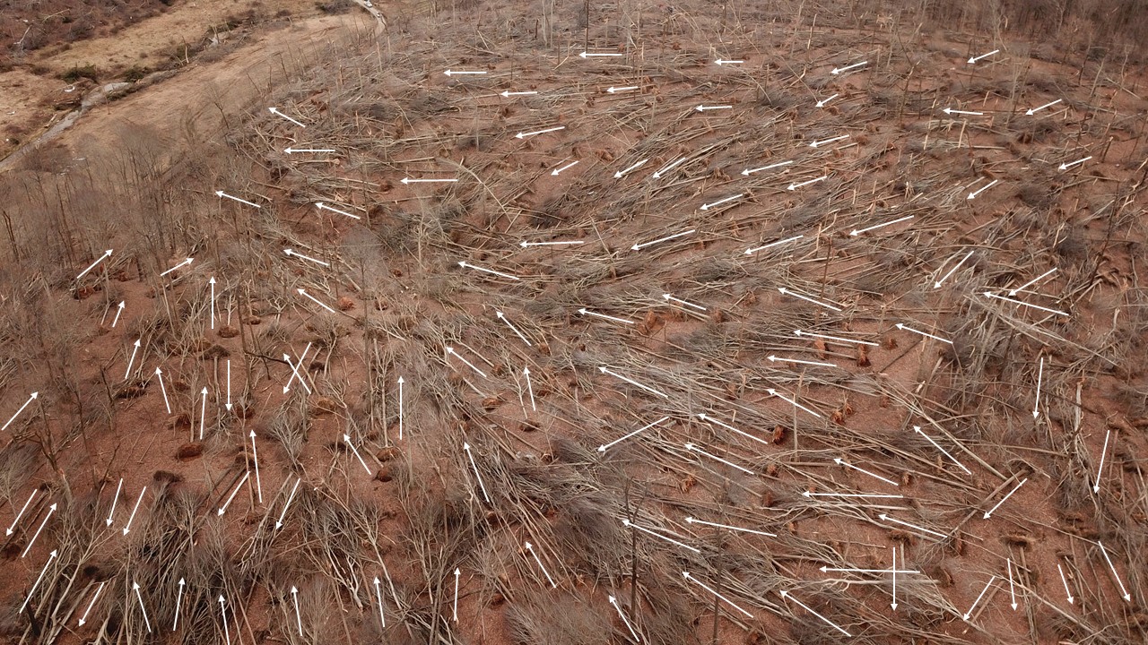
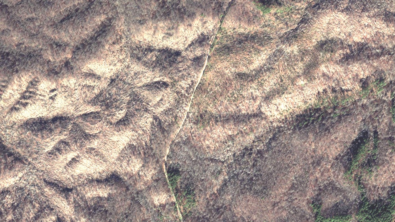
Winter storms occur after leaves have fallen off deciduous trees. As foliage is the most sensitive and most critical indicator of change that gridded remote sensing techniques use, this makes it difficult to distinguish where canopies are partially damaged and where minor wind led to leaf stripping--these gradients of impacts are apparent for tornados that occur during the growing season.
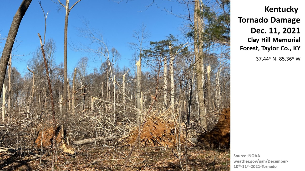
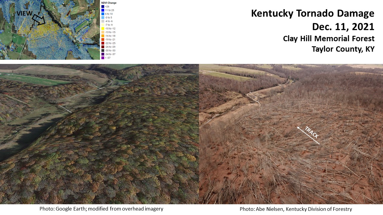
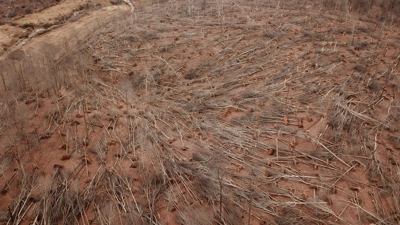
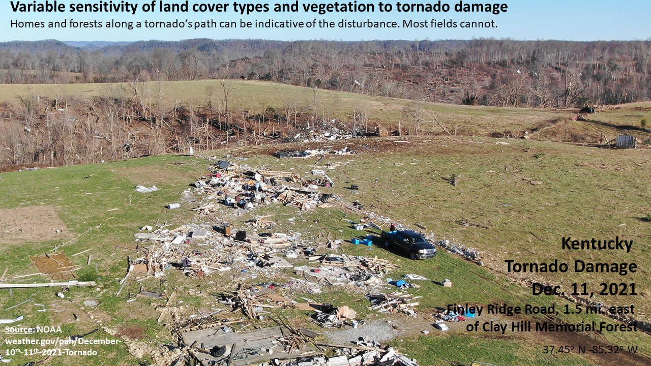
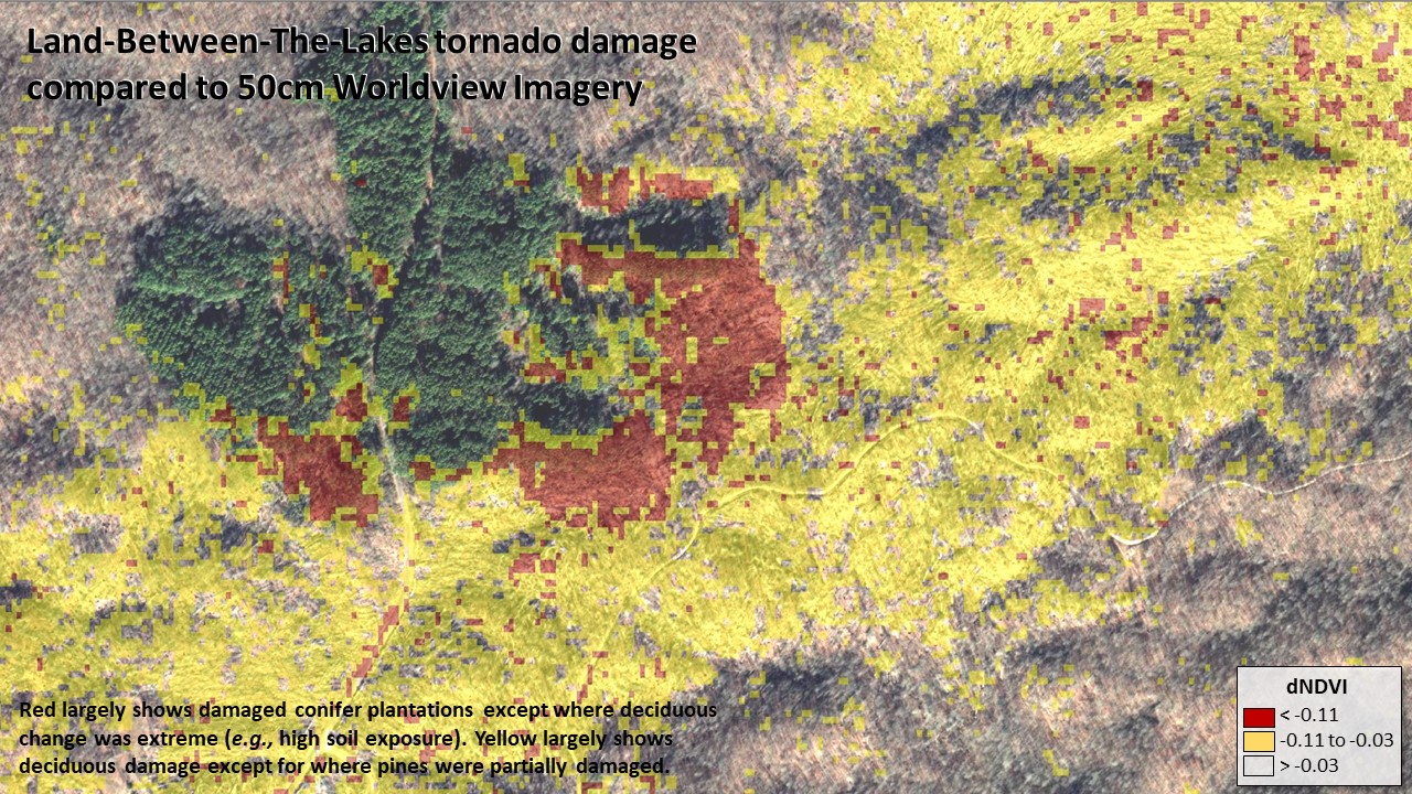
From field and drone surveys, areas that HiForm maps from yellow to red are typically devastated forest. The difference in color is indicative of the forest type that's affected. Only forest cover is shown in these maps through use of a recent National Land Cover Dataset mask.