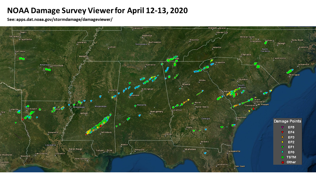
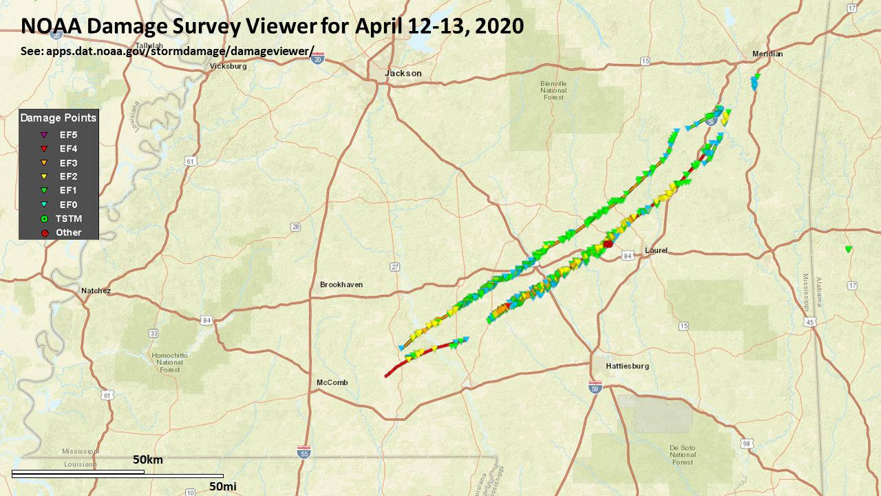
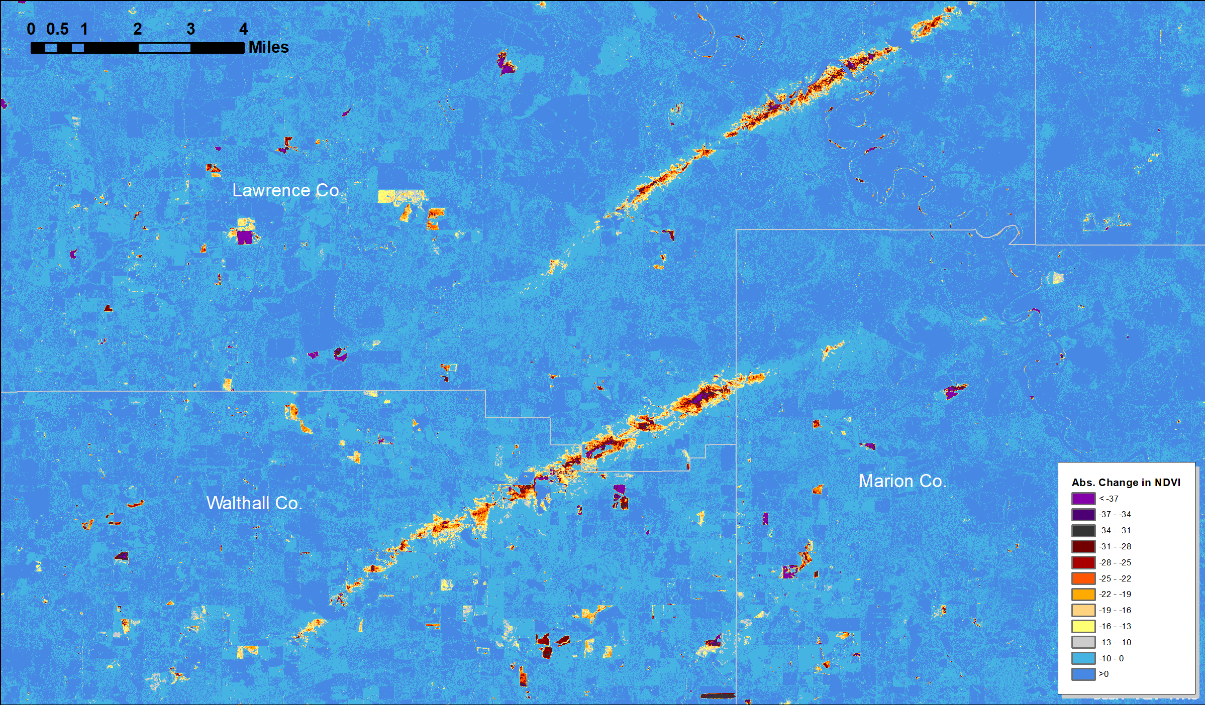
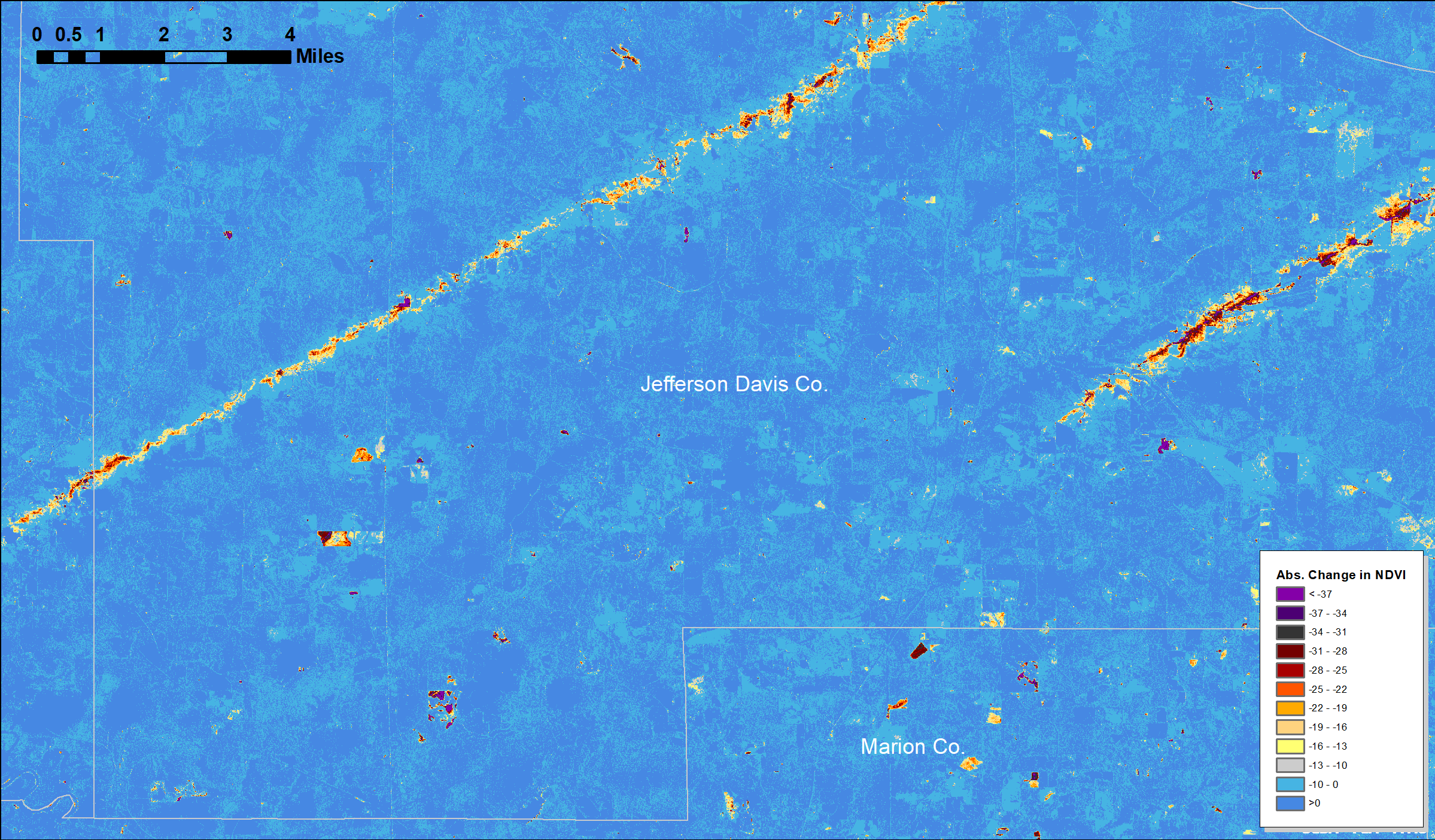
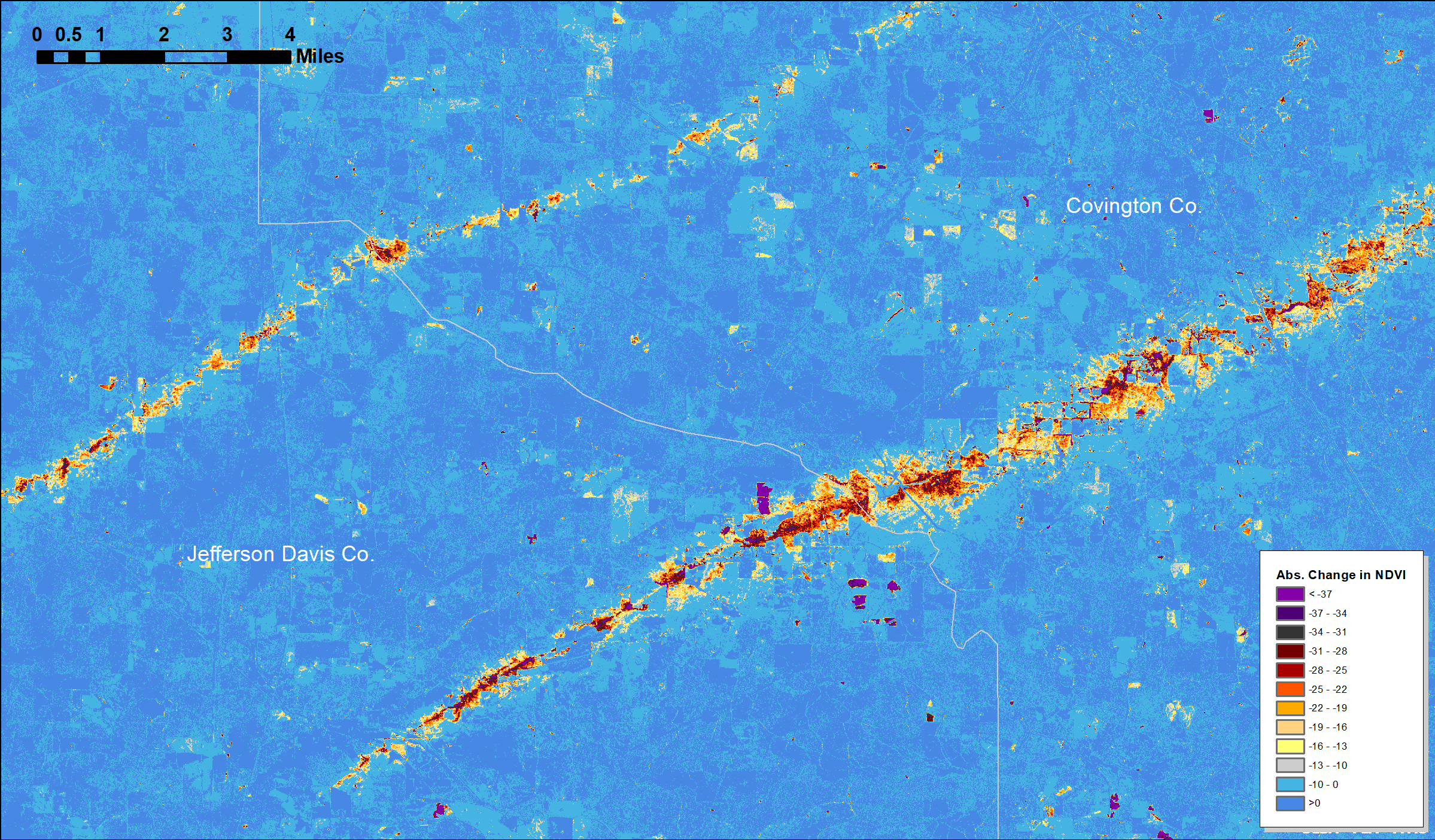
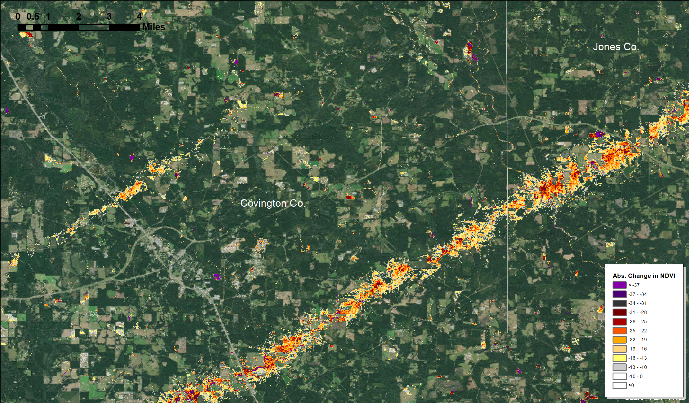
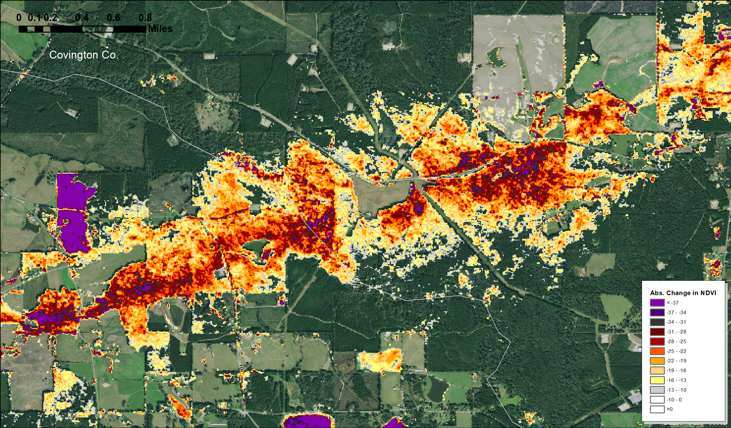
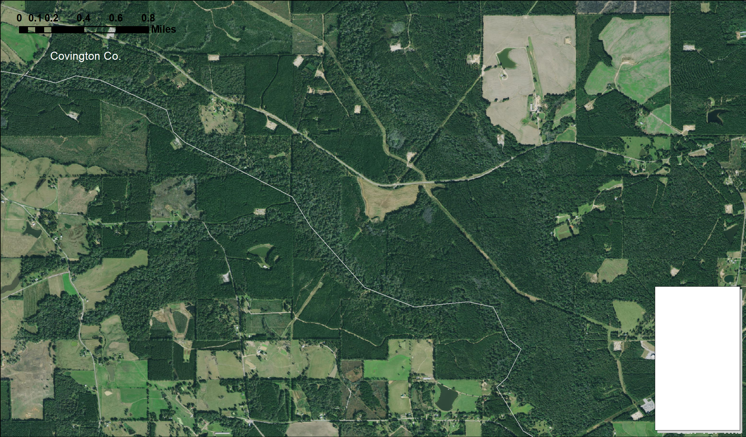
April 2020 MS Tornadoes
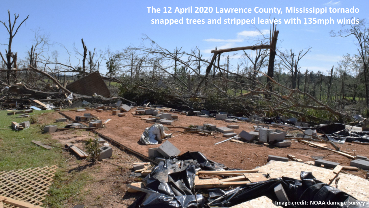
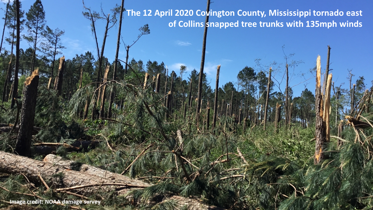
Among the greatest damage of the Southeast's Easter 2020 storms were these parallel tornadoes in central Mississippi. These were EF3 and EF4 storms that occurred on April 12, 2020.
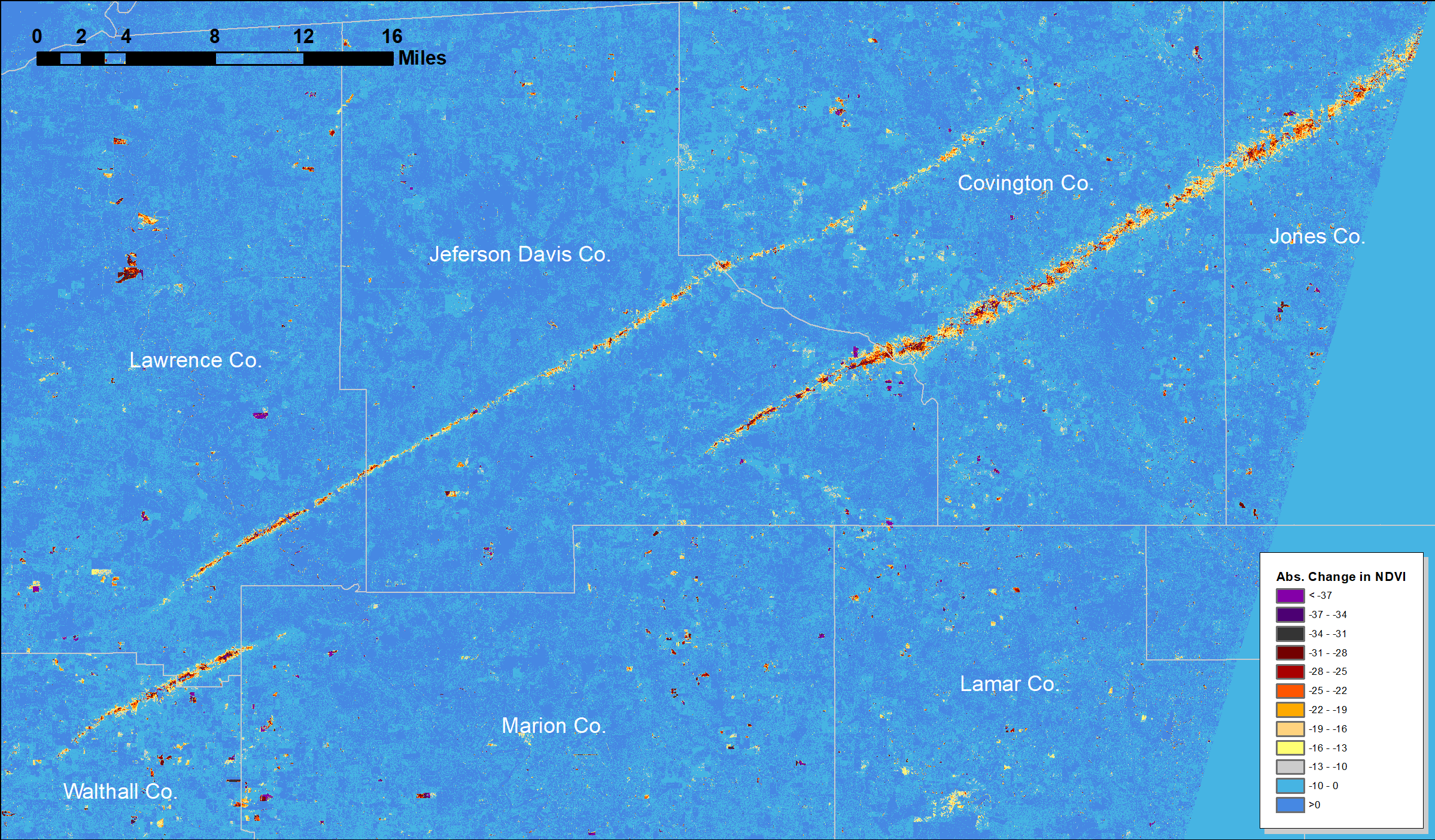
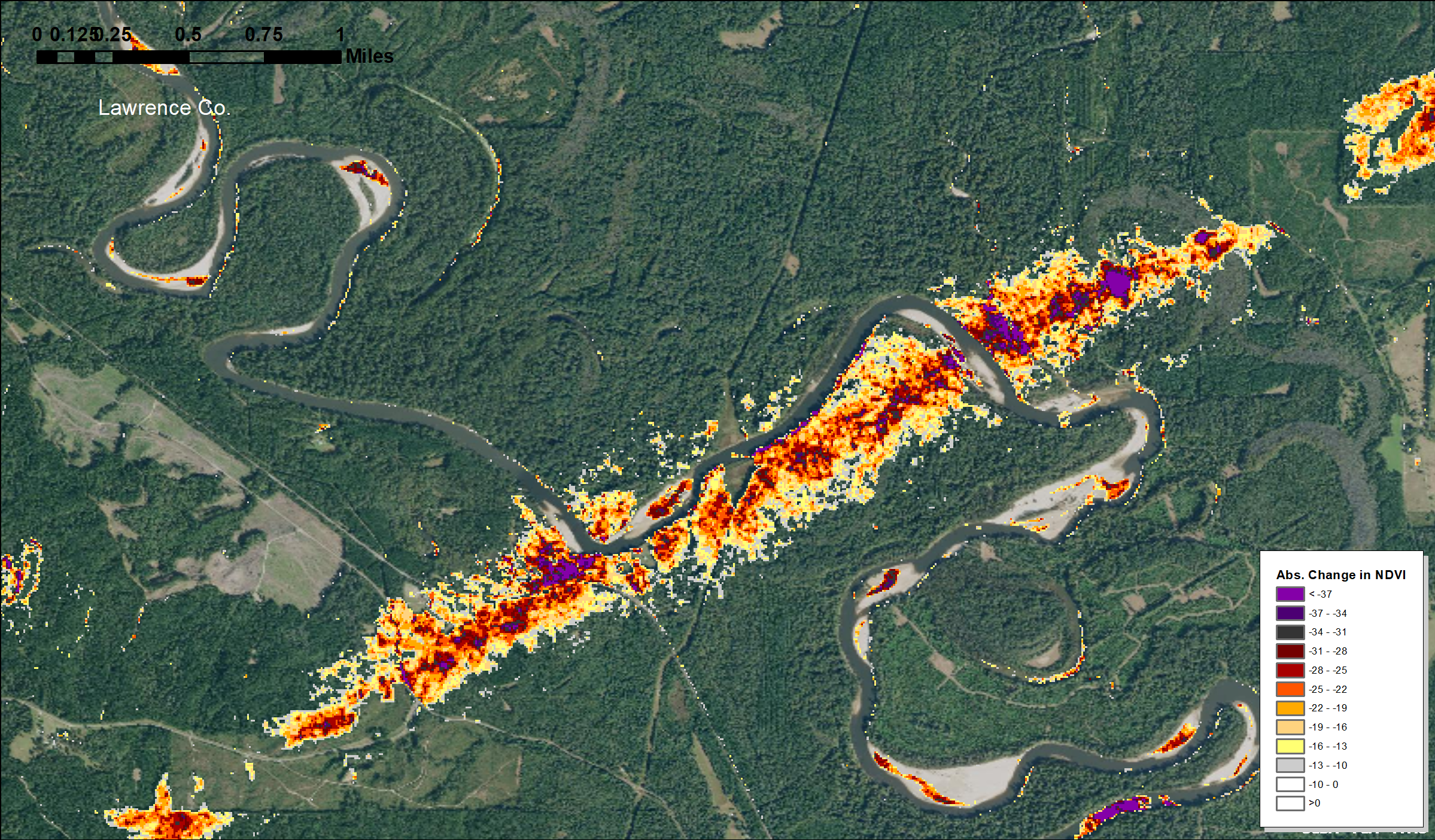
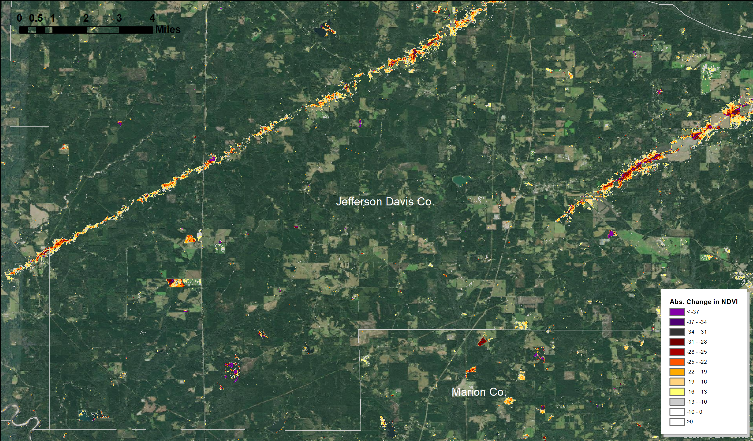
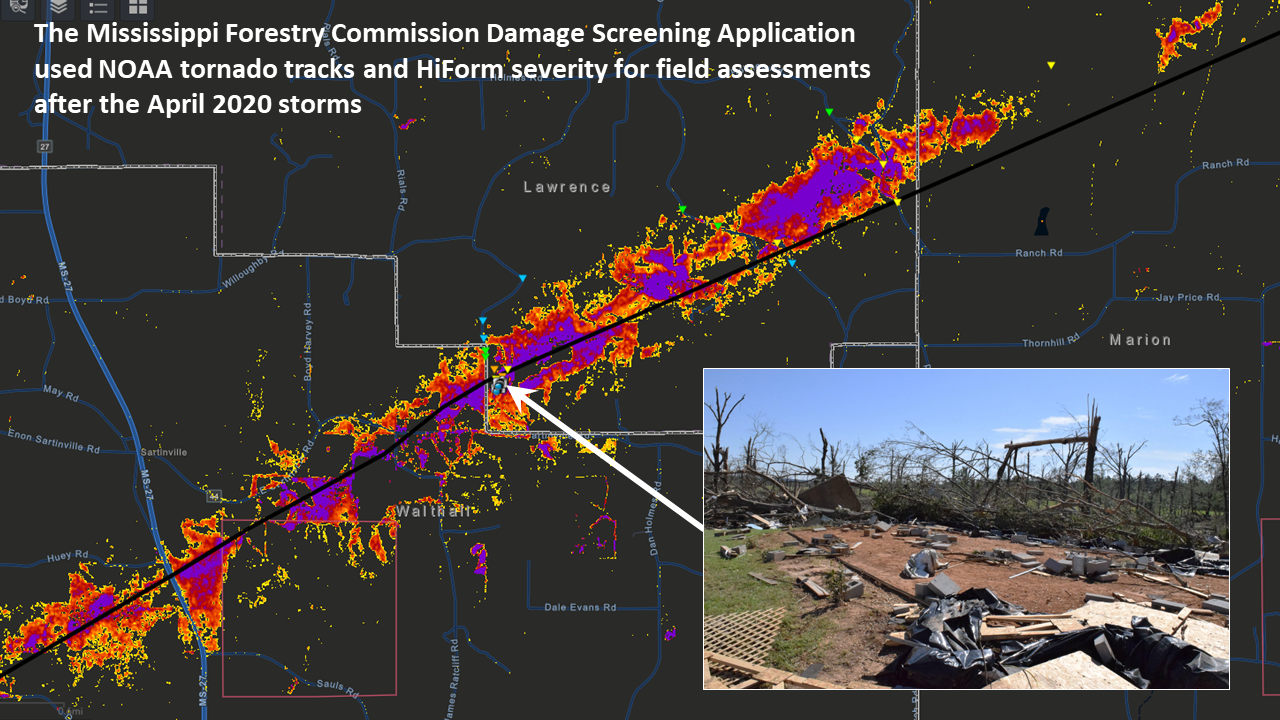
The maps shown below were derived from 10m-resolution Sentinel-2 satellite imagery taken immediately before and after the event. We used surface-corrected reflectance products in Google Earth Engine and drafted the maps shown below in ArcMap.
For the western half of the tracks, we used a pre-storm image for April 5th and a post-event image from the 15th. This is a 10 day gap during spring, and it can be difficult to resolve change from disturbance against the background increase in greenness of April. According to weekly MODIS NDVI time series available with the ForWarn II dataset (see https://forwarn.forestthreats.org), by the week ending Apr 13th, the deciduous forests of this area had reached 85% greenup--about 10% more than where it was on April 5th. That means there were plenty of leaves to be stripped from hardwoods, and that could confound our ability to resolve structural damage to trees.
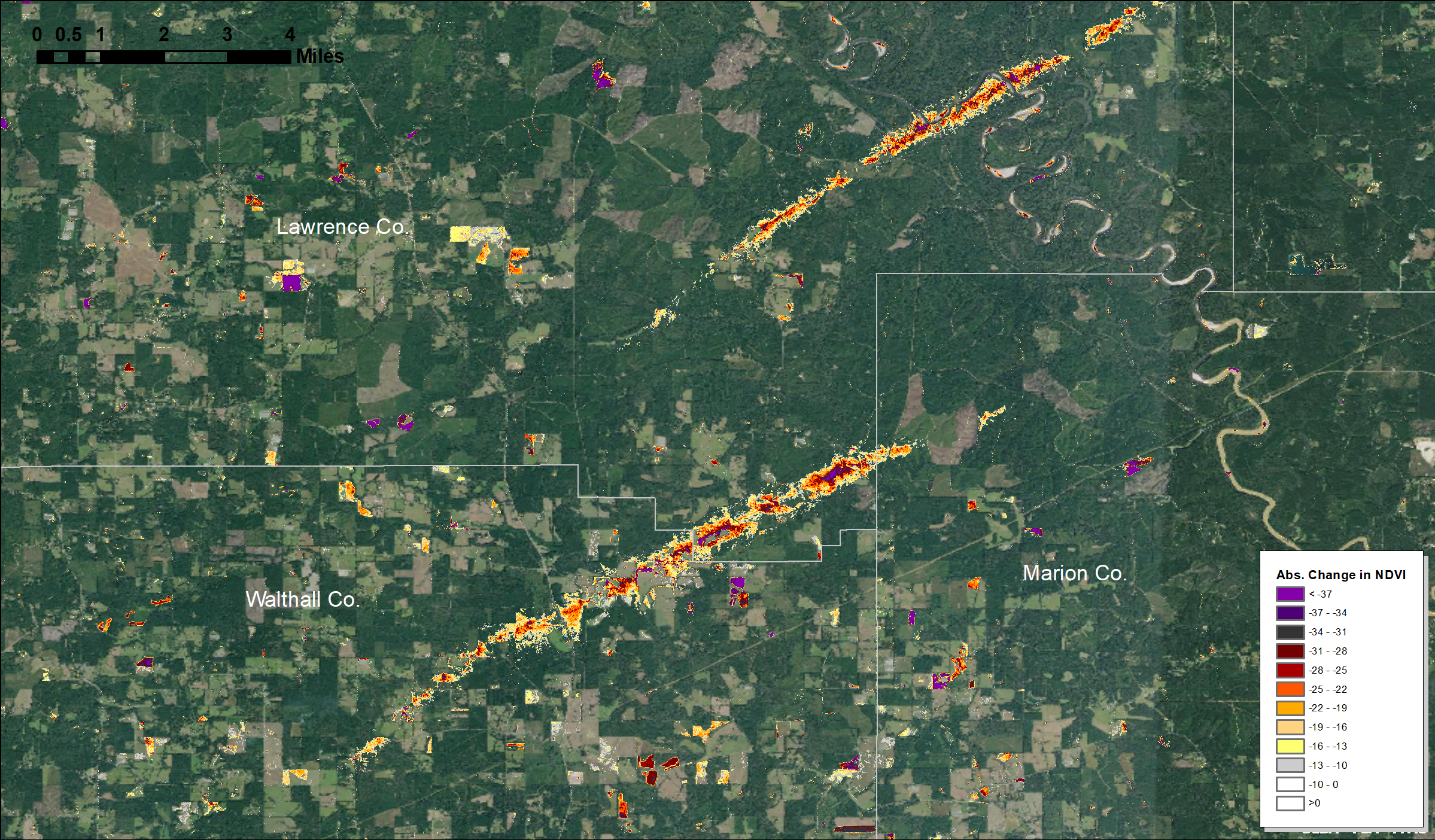
The colors shown represent relative change in NDVI and this gradient likely correlates with actual structural damage. In some areas more than others, this likely also includes leaf stripping of hardwoods and some standing water in low lying areas as well. Confirmation of impacts requires high resolution imagery, such as from a drone, or field observations.