2018 Hurricane Michael
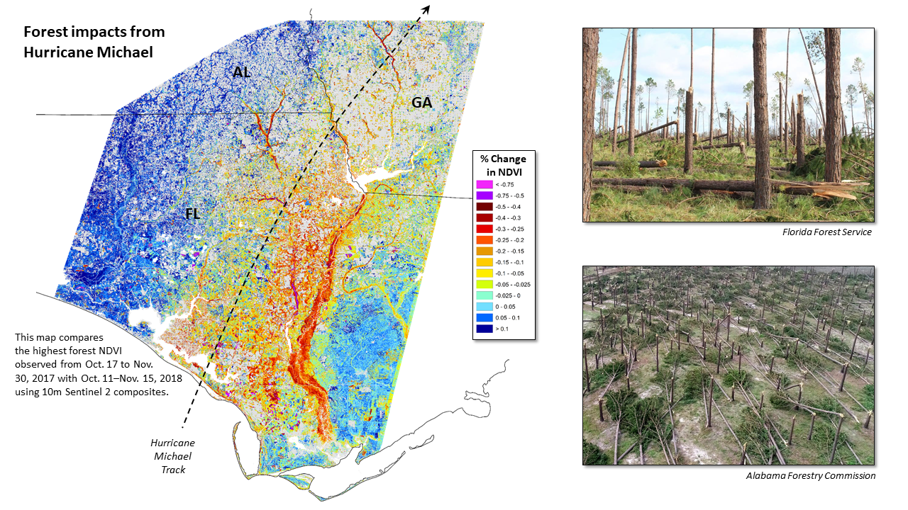
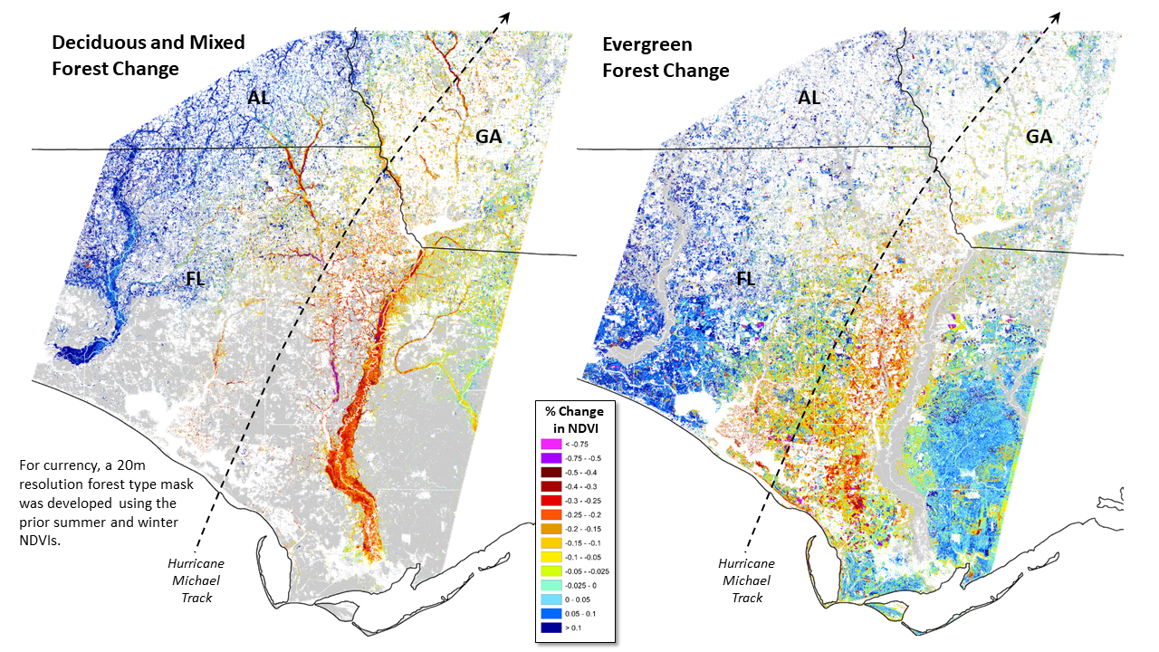
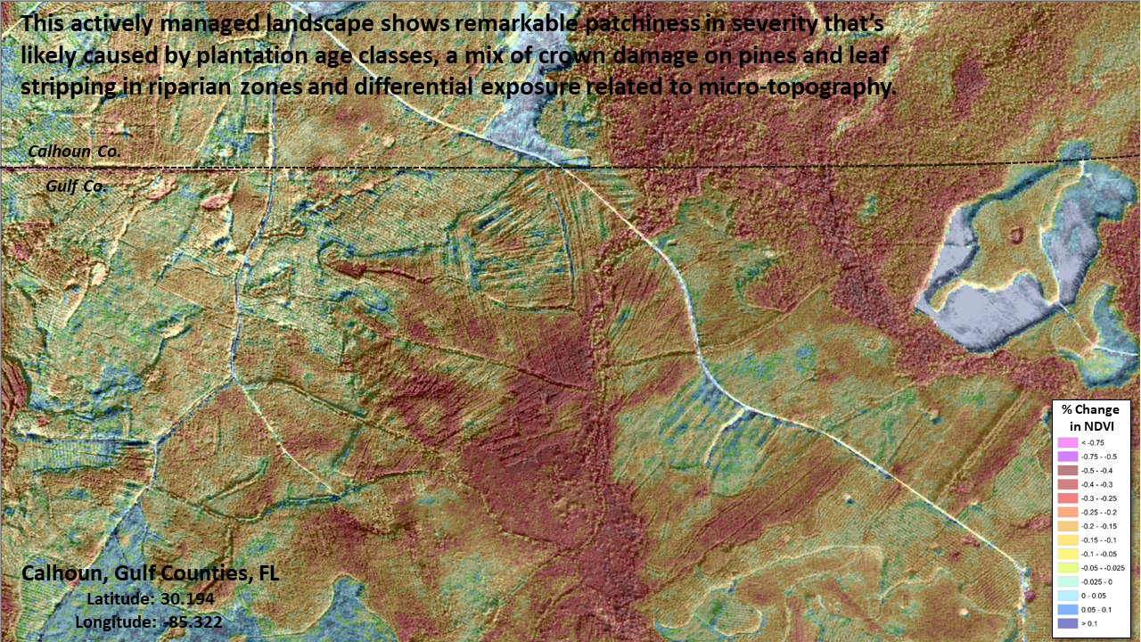
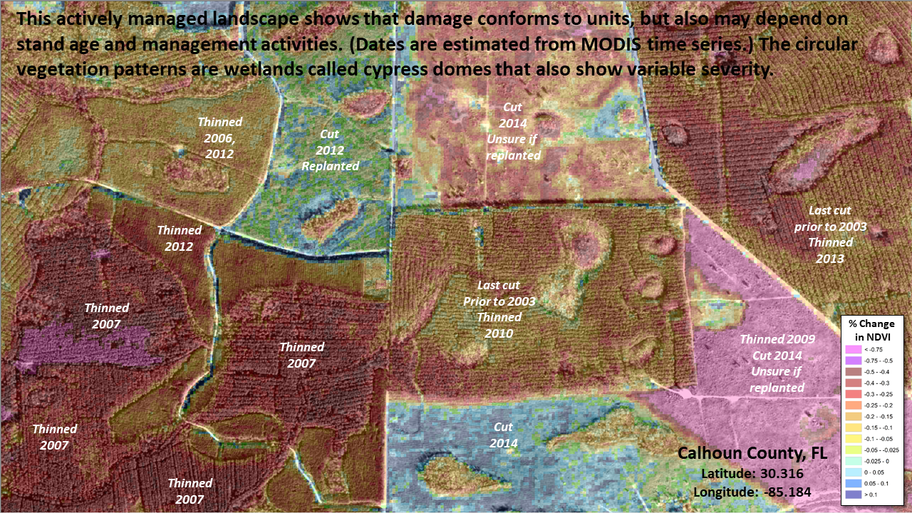
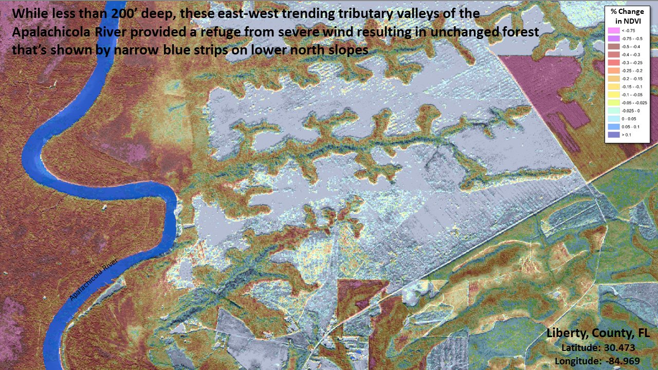
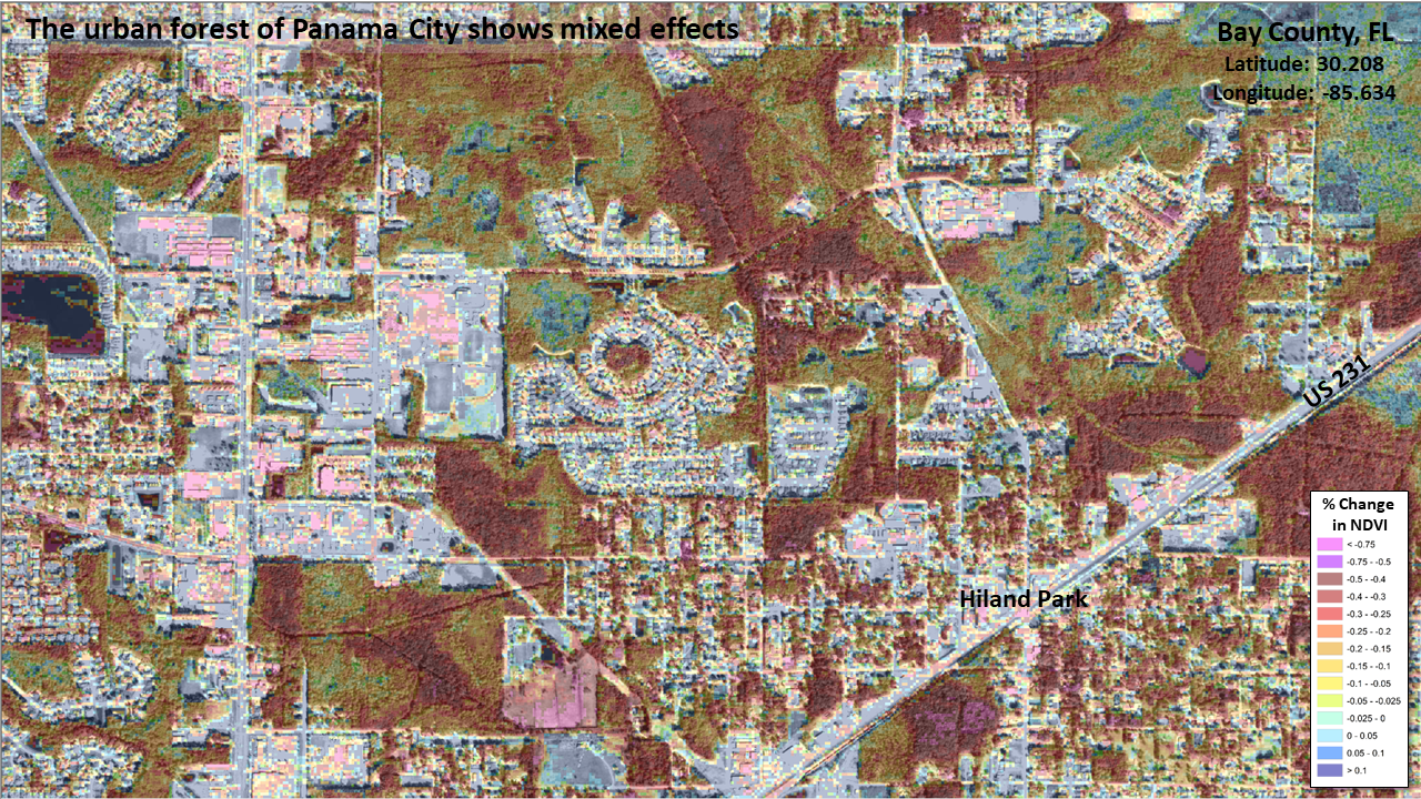
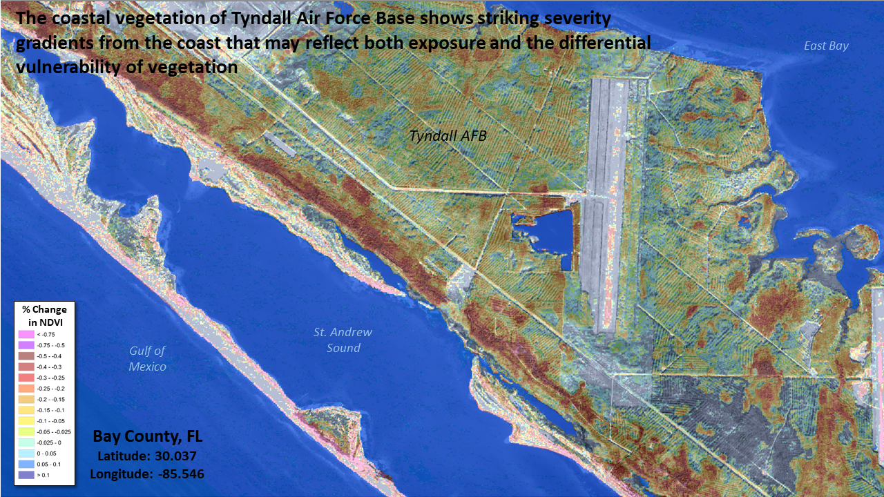
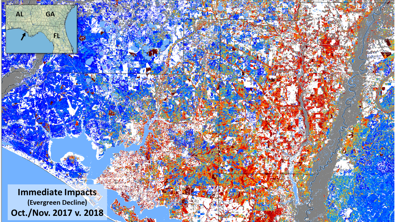
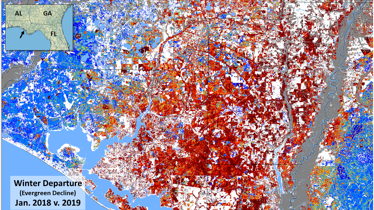
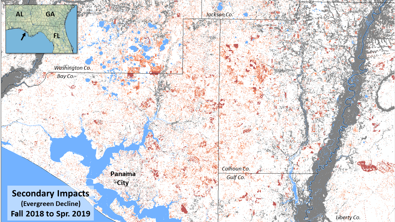
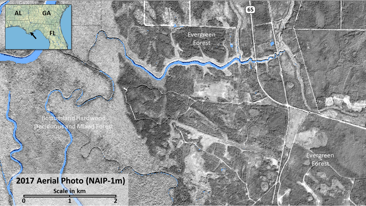
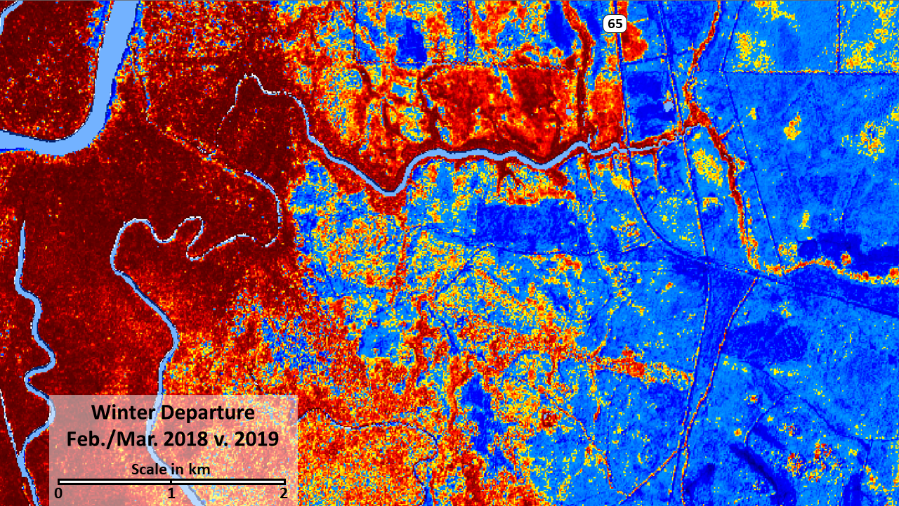
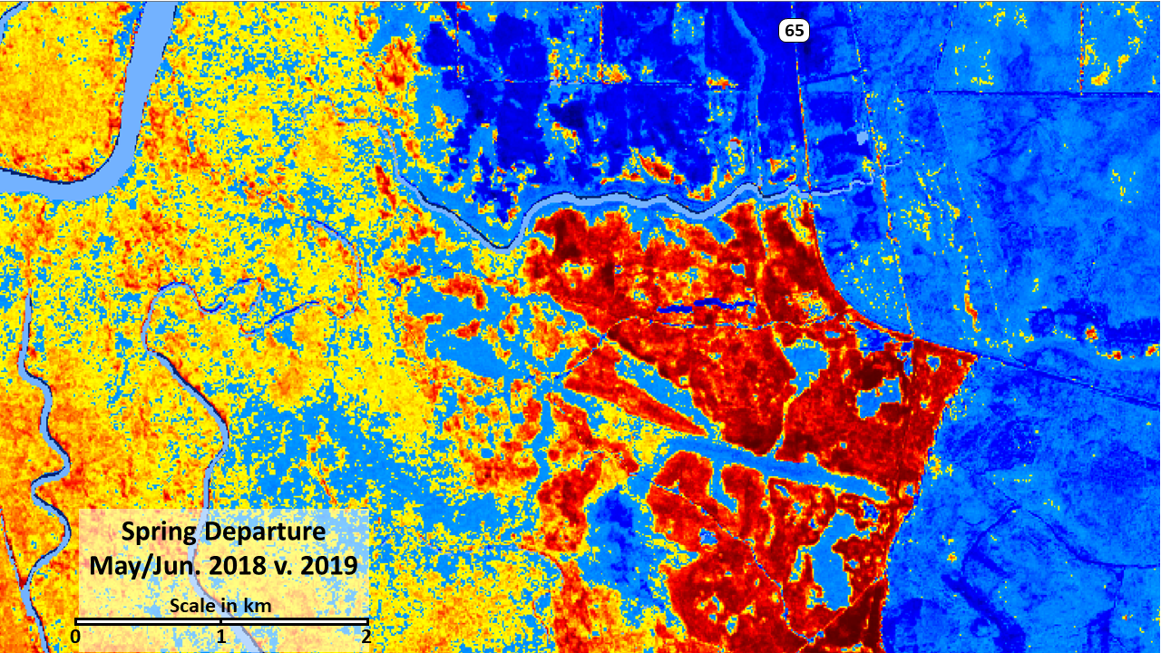
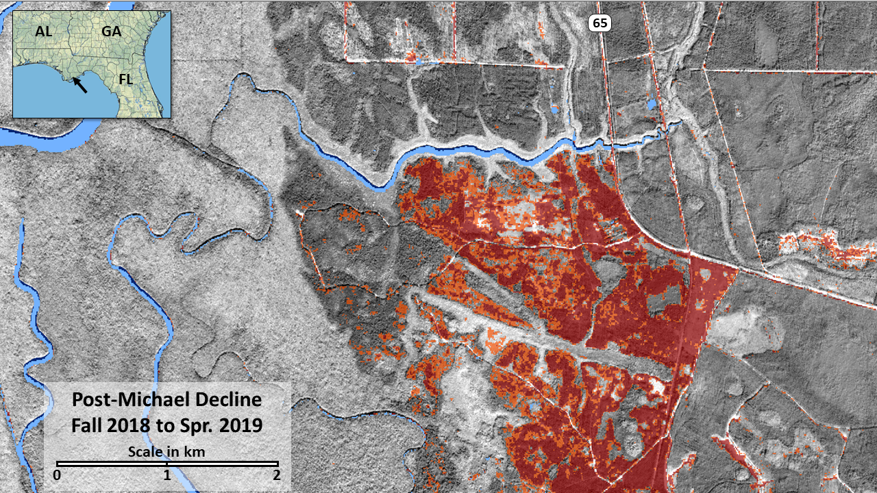
The powerful winds of Hurricane Michael devastated many forests across Florida, Georgia and Alabama in October of 2018. As a Category 4 storm, Michael's sustained winds uprooted and snapped trees across broad areas, with considerable financial impacts to the region's timber industry. Early estimates of damage were coarse, relying on assumptions about the area impacted and the vulnerability of different forest types. More precise and properly filtered post-storm change products can help refine these early estimates. After this event, we generated a sequence of impact maps using the change in NDVI at 10m from Sentinel 2 imagery. To separate deciduous from conifer impacts, we used an up-to-date forest type mask based on cross seasonal imagery. This mask nicely separated impacts to pine plantations from deciduous forests, that often experience relatively innocuous leaf stripping after strong wind. Viewing multiple events over a period of weeks let us better isolate the effects of standing water in bottomland forests that can artificially reduce the vegetation response signal as well. Further, an intensification of damage in the weeks after the storm likely related to browning of damaged crowns that were still green when the first change product was generated within a week after the storm passed.