1989 Hurricane Hugo
Hurricane Hugo was one of the most impactful hurricanes to strike the US during the 1980s. It's damage to South Carolina forests was particularly notable. Using the long-term Landsat 5 archive, HiForm's approach to monitoring impacts reveals strong damage in coastal forests north of Charleston, bottomland hardwoods (damage not likely to be related to ephemeral water damage or leaf stripping given the broad post-storm window used for this analysis) and to the pine forests of the Francis Marion National Forest in particular.

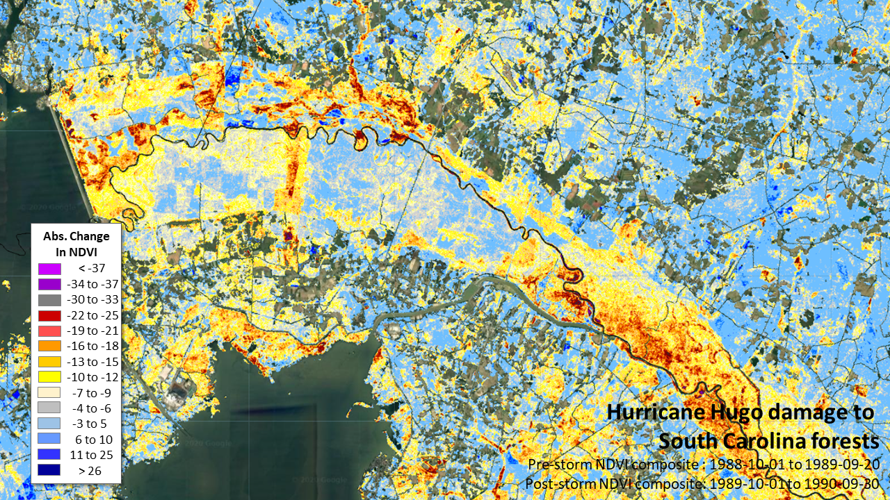

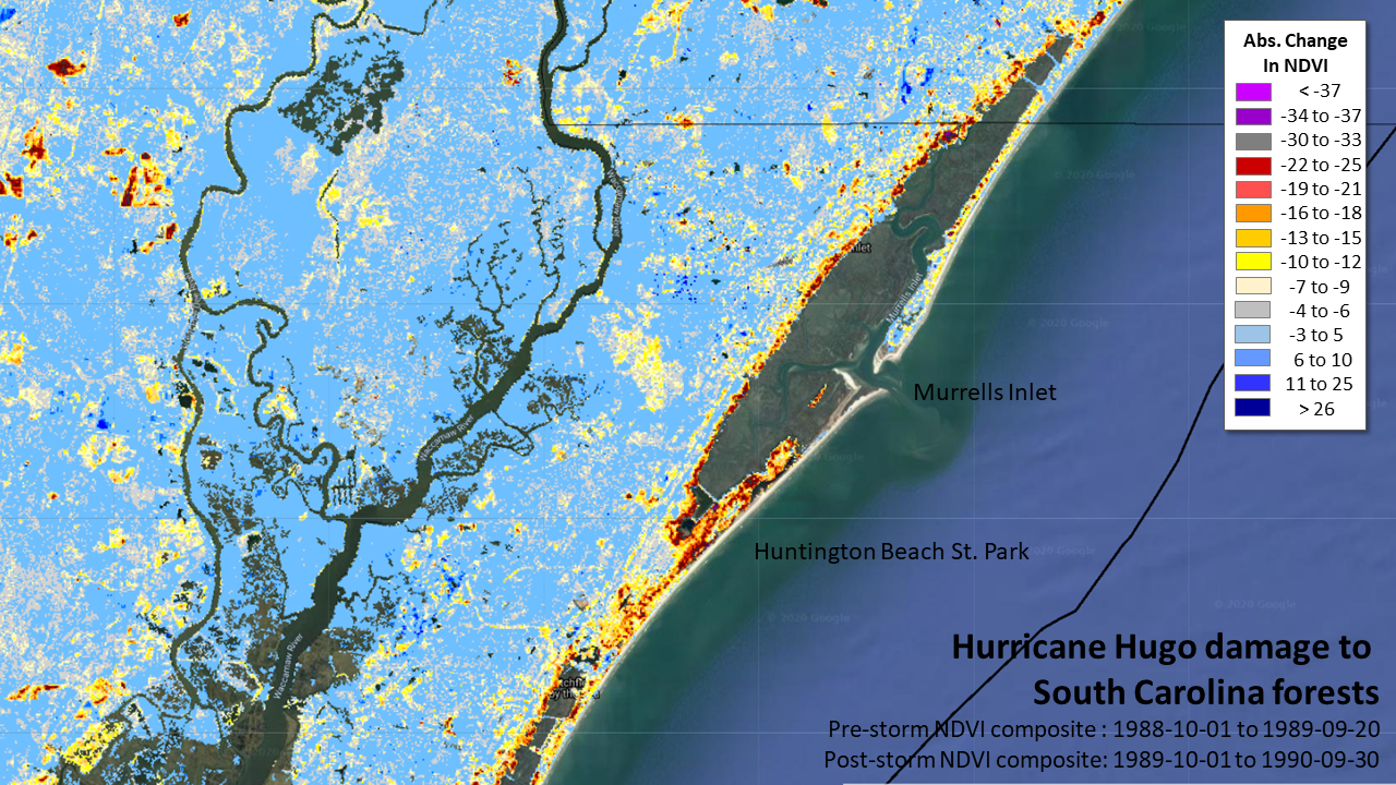
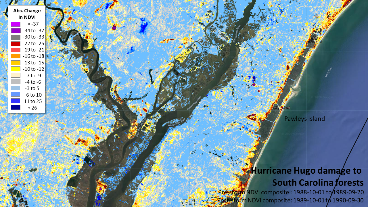

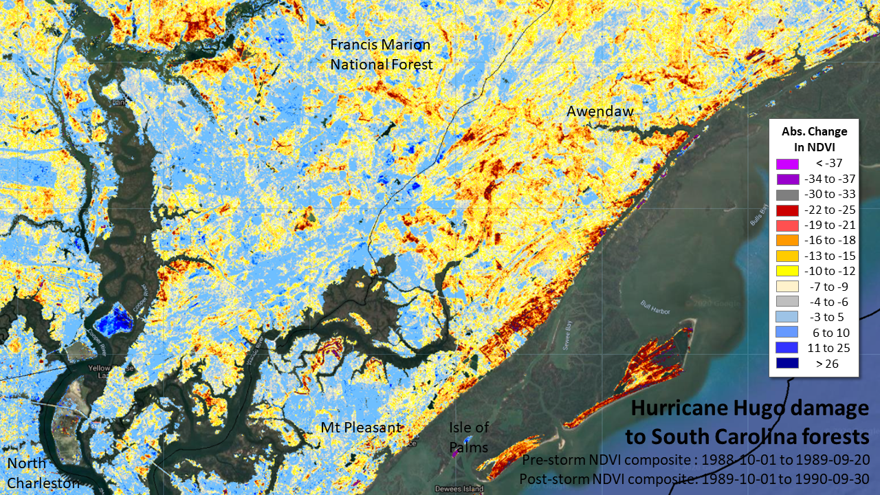
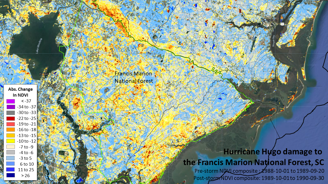
These maps were made with a full-year NDVI composite, meaning the greenest conditions observed over the prior and post-storm 12 months were used to view change. Landsat frequency is low, so such broad windows can be useful. The tradeoffs are that infrequent imagery often retains paired image incompatibility for phenological or illumination reasons, and these can often be overcome by local, targeted efforts. Many dates used in this composite were from May, July or August 1990. When there's a cloud-free view available prior to any salvage logging, this max-NDVI value technique selects for the pre-logging image, thereby capturing the direct hurricane impacts over the secondary impacts.
Particularly striking is the impacts to bottomland hardwoods. We often see a mottled pattern of NDVI decline soon after hurricanes on these low-lying, floodplain sites, and patterning often results from standing water (which when visible through a leaf-stripped canopy lowers NDVI as much as the loss of hardwood leaves does). As this post-Hugo composite includes images through the 1990 growing season, these areas seem likely to have suffered real and substantial structural damage.
References