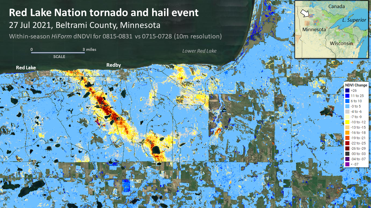
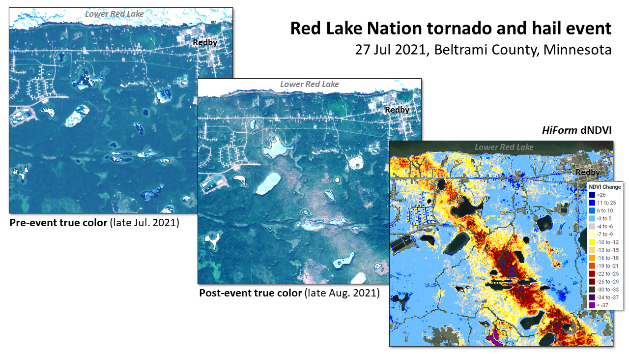
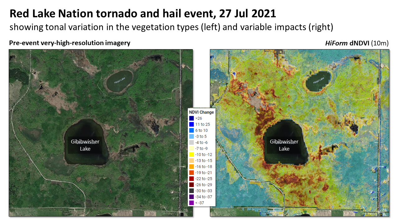
July 2021 Red Lake Nation Tornado and Hail Event
Summer wind and hail storms are a regular occurrence in the Upper Midwest with forest impacts that have been poorly mapped, historically. These events can cause severe canopy damage that lasts for years or strip foliage which is less likely to recover late in the growing season with implications for annual growth. Both coarse resolution imagery from MODIS or Sentinel 3 readily detect disturbances like this, and in time they can be precisely mapped at near-canopy resolution (10m) using tools like HiForm.
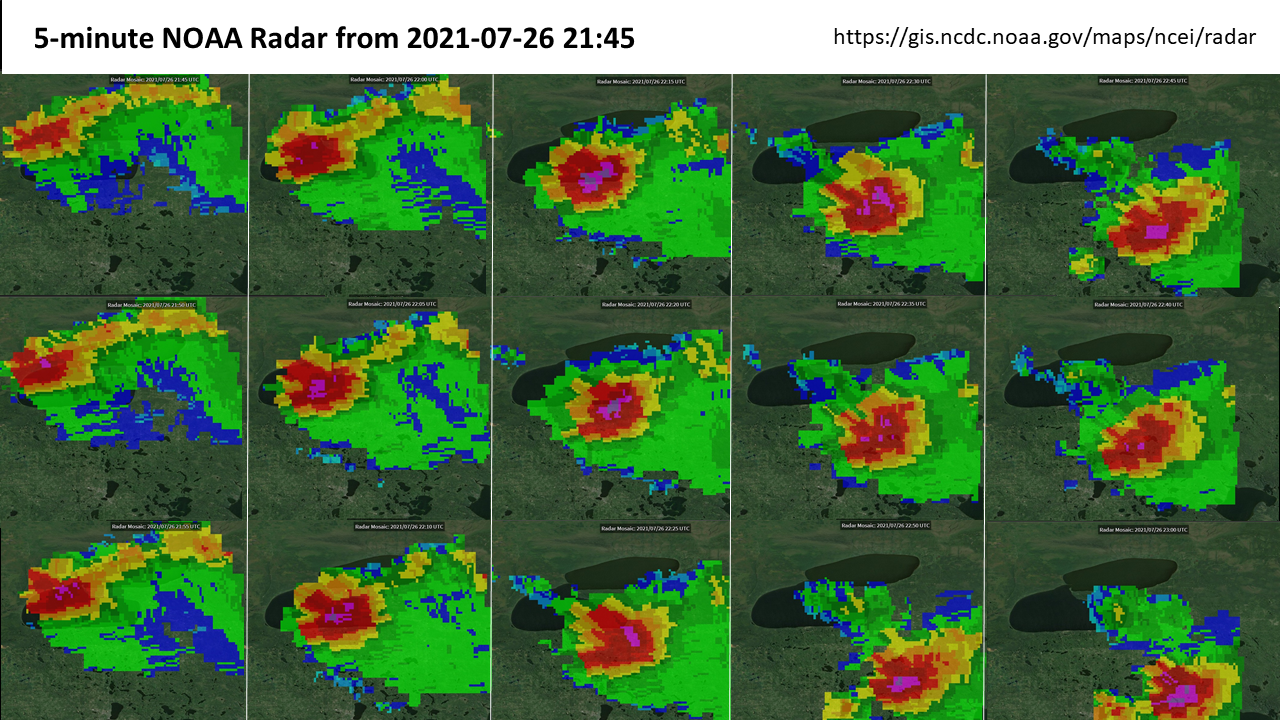
NOAA records for July 27 2021 confirm two parallel EF2 tornadoes the impacts of which are clearly shown below and an EF0 to the south where remote sensing does not show much damage. Field reports describe damaging quarter to half dollar-sized hail that contributed to the area affected by these near-shore tornadoes.