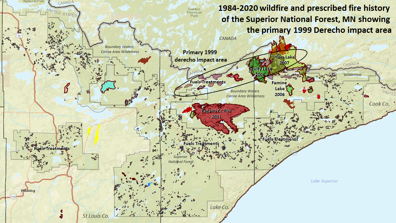
1999 Boundary Waters Canoe Area Derecho
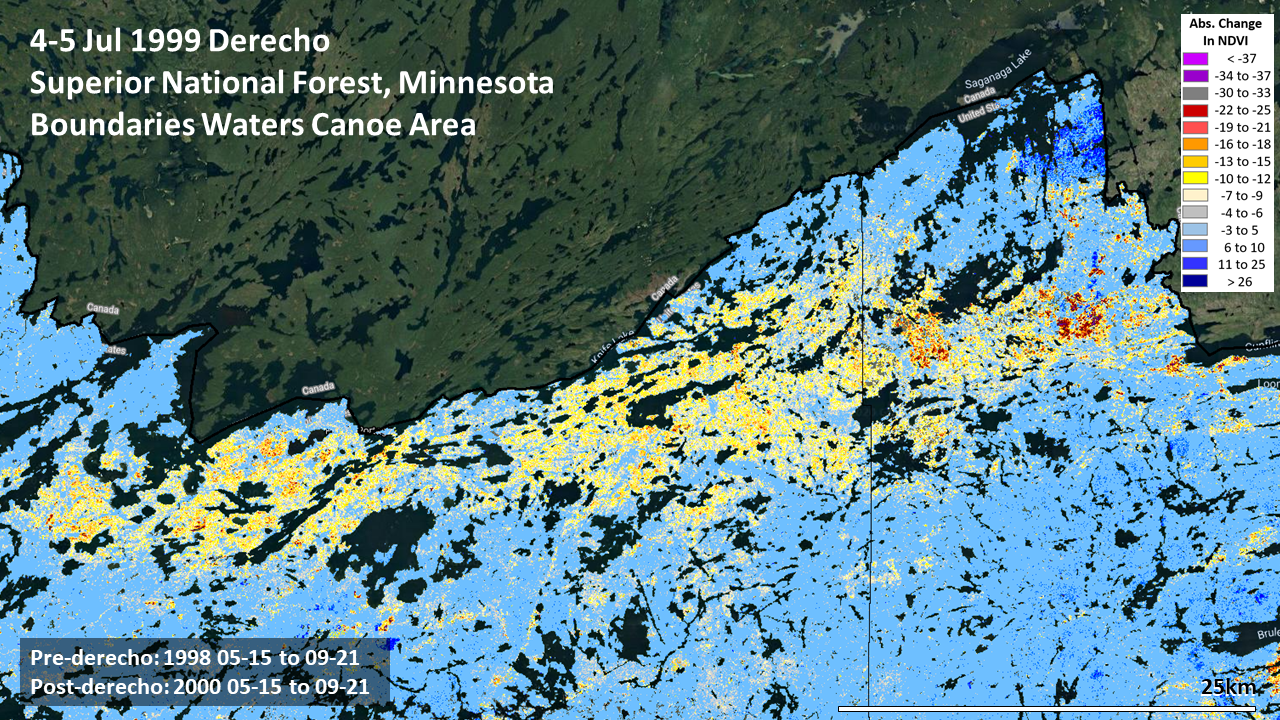
Among the most remarkable derechos to have impacted the National Forests of the US in recent decades occurred on the fourth of July 1999. It crossed through the Superior National Forest near the Canadian border. The Boundary Waters Canoe Area Wilderness was hit especially hard, as were a large number of campers and canoeists who were on holiday there and then.
A vast number of trees were snapped off by high winds that surged in excess of 90 mph. Estimates were that 25 million trees were killed over 370,000 of the 1 million acres of the Wilderness area. That is roughly a third of the Wilderness area.
Using Landsat 5 in HiForm, the damaged area was mapped to be about 50km (30 miles) long and from 5 to 20km (4 to 12 miles) wide, consistent with earlier assessments.
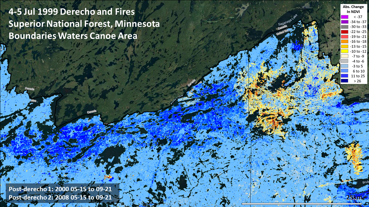
With so much blowdown over a vast portion of a popular area for recreation concerns quickly rose about the risk of catastrophic fire. As this was Wilderness, options for fuels treatment were limited and campers like fire. Over subsequent years, several large wildfires did occur, including the 7-14-2006 Cavity Lake Fire, the 5-5-2007 Ham Lake Fire and, south of the most strongly affected area, the massive 8-17-2001 Pagami Creek Fire. To reduce the catastrophic fire hazard, the Superior National Forest has conducted several large prescribed fires here, though the hazard of large wildfire is likely to remain for some time to come.

References
Boundary Waters The Fire Next Time: https://web.archive.org/web/20070405142656/http://www.dnr.state.mn.us/volunteer/mayjun00/blowdown.html
NOAA Boundary Waters-Canadian Derecho https://www.spc.noaa.gov/misc/AbtDerechos/casepages/jul4-51999page.htm
Moser, W. Keith; Hansen, Mark H.; Nelson, Mark D.; Crocker, Susan J.; Perry, Charles H.; Schulz, Bethany; Woodall, Christopher W. 2007. After the blowdown: a resource assessment of the Boundary Waters Canoe Area Wilderness, 1999-2003. Gen. Tech. Rep. NRS-7. Newtown Square, PA: U.S. Department of Agriculture, Forest Service, Northern Research Station. https://www.fs.usda.gov/treesearch/pubs/12286
Nelson, Mark D.; Moser, W. Keith. 2007. Integrating remote sensing and forest inventory data for assessing forest blowdown in the boundary waters canoe area wilderness. In: Greer, J.D., ed. New remote sensing technologies for resource managers; proceedings of the eleventh Forest Service remote sensing applications conference; 2006 April 24-28; Salt Lake City, UT. American Society for Photogrammetry and Remote Sensing: 8 p. https://www.fs.usda.gov/treesearch/pubs/19856